
Pricing Change
New pricing for orders of material from this site will come into place shortly. Charges for supply of digital images, digitisation on demand, prints and licensing will be altered.
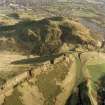
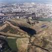
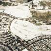
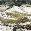
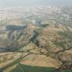
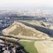
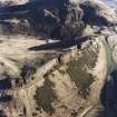
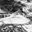
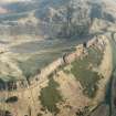
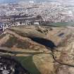
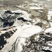
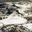
Edinburgh, Holyrood Park, Galloping Glen


Track(S) (Period Unassigned)
Site Name Edinburgh, Holyrood Park, Galloping Glen
Classification Track(S) (Period Unassigned)
Alternative Name(s) Queen's Park; Salisbury Crags
Canmore ID 157252
Site Number NT27SE 3948
NGR NT 2704 7283
NGR Description Centred NT 2704 7283
Datum OSGB36 - NGR
Permalink http://canmore.org.uk/site/157252


- Council Edinburgh, City Of
- Parish Edinburgh (Edinburgh, City Of)
- Former Region Lothian
- Former District City Of Edinburgh
- Former County Midlothian
NT27SE 3948 centred 2704 7283
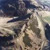
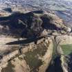
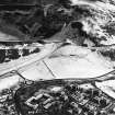
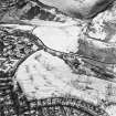
Fragments of several tracks lead up to the foot of the scree slope below Salisbury Crags, but are now lost in dense gorse. They are all probably associated with quarrying, and are shown in part on the OS 1:1056 map in 1854 (Edinburgh and its environs 1854, sheet 41). They are plotted at 1:5,550 on an archaeological map of Holyrood Park (RCAHMS 1999).
Visited by RCAHMS (ARG), 15 December 1998.
NMRS, MS/726/96 (64-5, no. 60); RCAHMS 1999.

