
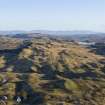
Luing, Achafolla


Farmstead (19th Century), School (19th Century)
Site Name Luing, Achafolla
Classification Farmstead (19th Century), School (19th Century)
Alternative Name(s) Achafolla Croft
Canmore ID 155825
Site Number NM71SW 23
NGR NM 74269 10292
Datum OSGB36 - NGR
Permalink http://canmore.org.uk/site/155825


- Council Argyll And Bute
- Parish Kilbrandon And Kilchattan
- Former Region Strathclyde
- Former District Argyll And Bute
- Former County Argyll
Depicted on the 1st and 2nd editions of the O.S. 6-inch maps (Argyllshire), 1884, 1898, sheet CXXIX, SE.
Information from RCAHMS (SM), 12th January 2000.
Luing, Schoolhouse
EXTERNAL REFERENCE
Scottish Records Office
GD 112/15 Vouchers of Factors Accounts 1643-1797
Note (16 February 2022)
NM71SW 23 74269 10292
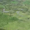
A small farmstead of three buildings is depicted here on both an estate map of 1847 (NRS, RHP571), where it is annotated ‘Achapholla Croft Steading’, and on the 1st edition of the OS 6-inch map (Argyllshire, sheet cxxix, 1880), where the principal building is annotated ‘School’. The OS surveyors described it thus: ‘A small school at Achafolla, being part of a farm steading the property of the Earl of Breadalbane. The teacher, who also tills the croft, receives an allowance from the parish and school fees’ (OS Name Book Argyllshire No. 53, p.167).
By the time the 2nd edition of the OS 6-inch map was published in 1900 (Argyll and Bute, sheet cxxix.SE) the building had reverted to its principal use, with the function of school being taken over by a purpose-built structure 160m to the N.
Information from HES Archaeological Survey (GFG), 16 February 2022.

