Pricing Change
New pricing for orders of material from this site will come into place shortly. Charges for supply of digital images, digitisation on demand, prints and licensing will be altered.
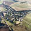
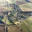
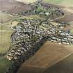
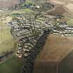
Auldearn, Dooket Hill
Motte (Medieval)
Site Name Auldearn, Dooket Hill
Classification Motte (Medieval)
Alternative Name(s) Castle Of Auldearn; Castle Hill; Auldearn, Doocot Hill; Auldearn Motte; Boath Motte
Canmore ID 15538
Site Number NH95NW 11
NGR NH 9172 5562
Datum OSGB36 - NGR
Permalink http://canmore.org.uk/site/15538
- Council Highland
- Parish Auldearn
- Former Region Highland
- Former District Nairn
- Former County Nairn
NH95NW 11 9172 5562
(NH 9172 5562) Dooket Hill (NR)
(Supposed to have been A Mote Hill (NR)
OS 6" map (1906)
See also NH95NW 8 and NH95NW 27.
Castle, or Doocot, Hill, a motte, is the site of the Royal Castle of Auldearn of William the Lion (1165-1214). In support of this statement the National Trust write (List of Properties 1959) that the second charter of the Burgh of Inverness was signed at Auldearn by William the Lion some time after 1180 and (letter from NTS, 1 June 1966) the Earl of Ross submitted to Robert Bruce at the Castle of Auldearn in 1308. They deduce from this that 'it is safe to say that there was a royal castle here which dated back to the 12th century, but whether it was built by William the Lion or not cannot be determined.'
The outline of the ditch is still clearly visible.
(Unmdated) information in NMRS.
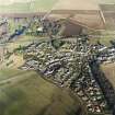
The motte on Dooket or Castle Hill overlooks the village of Auldearn. It measures 59.0m in diameter externally by 8.0m high. The flat central area enclosed by a rampart, measures 32.0m E-W by 27.0m transversely, in the centre of which is a 17th century dovecot (NH95NW 8). No trace of an outer ditch could be seen, and the external slopes are bounded by a modern wall.
Resurveyed at 1/2500.
Visited by OS (RD) 26 November 1965
NH 917 556 An evaluation on a site immediately to the SW of Dooket Hill Motte (NMRS NH95NW 11) revealed several isolated pits and gullies. A large spread of redeposited gravel was present in the NE corner of the evaluation area; it overlay an area of natural subsoil which appears to have been quarried out or pitted. This was bounded on its northern extremity by two artificial gullies, one of which was filled with rounded stones.
A large ditch oriented SE-NW was located on the SE edge of the evaluation area, but was not identified elsewhere. A large spread of burnt material was identified at the bottom of the slope, though it did not appear to have any structure to it. None of these features contained any datable material.
A report has been lodged with the NMRS.
Sponsor: Highland Council.
B Glendinning 1999
NH 917 556. The report on the above site gives details of the archaeological features identified during the evaluation. The report also gives several recommendations concerning proposed development for the site. Housing proposed for the area of the farmyard should not affect any of the archaeology as long as it does not impact on the whin bushes to the NW of the site. The farm buildings them selves are modern and do not require recording. The proposed car park is on a area of deep top soil and the archaeological features (burnt deposit and small gully) could be left in place as long as a sufficient depth of overburden is used. The root of the proposed path is believed to cross the area of trench three. Dew to the density of the archaeology and the lack of topsoil in that area further work is recommended before putting the path in place.
Sponsors: Highland Council
NMRS MS/726/146 (Edinburgh University Centre for Field Archaeology, January 1999)
A topographic survey was conducted of Dooket Hill, the motte upon which the doocot stands (NMRS NH95NW 8). The motte may have formed the focus of a more substantial fortification, there perhaps having been a bailey outwith the survey area to the E and now built over. A well-preserved embankment that encloses the summit of the motte may represent subsequent modification. Whether the embankment relates to royalist preparations before the 1646 Battle of Auldearn cannot be determined without excavation. A substantial depression in the NE part of the summit may represent the quarry source for its construction and, if so, would consequently represent a secondary development.
The embankment is irregularly formed with a series of dips or shallow depressions, four or five to the W and two to the NE. It is considered at least possible that these represent gun emplacements hastily formed in preparation for the 1646 battle, those to the W commanding the battlefield and those to the NE protecting the flank of the royalist position. The latter are particularly suggestive, with apparent platforms within the embrasures.
On the SE part of the summit low earthworks suggest a rectangular structure or building platform; whether this relates to the Civil War period cannot be known without physical investigation.
Sponsor: National Trust for Scotland.
T Addyman 2000
Scheduled with NH95NW 8 as Dooket Hill, motte and doocot, Auldearn.
Information from Historic Scotland, scheduling document dated 21 December 2000.
NH 917 556 A fencing contract to enclose the motte at Auldearn (NH95NW 11) required a watching brief to comply with Scheduled Monument Consent. The fence posts were driven into the ground after slight holes had been prepared using a 'scissor' spade. Nothing of archaeological interest was recorded.
Archive to be deposited in the NMRS.
Sponsor: NTS.
J Harden 2002.
Field Visit (22 September 1943)
This site was included within the RCAHMS Emergency Survey (1942-3), an unpublished rescue project. Site descriptions, organised by county, vary from short notes to lengthy and full descriptions and are available to view online with contemporary sketches and photographs. The original typescripts, manuscripts, notebooks and photographs can also be consulted in the RCAHMS Search Room.
Information from RCAHMS (GFG) 10 December 2014.
Field Visit (19 April 1999 - 22 April 1999)
Survey of Dooket Hill permitted close scrutiny of the form of the earthwork. While limited vegetation removal permitted access in some areas (notably in the area of the entrance) a number of zones on the lower slopes remained inaccessible. The survey was extended to the NTS property boundary, the remains of a dry stone retaining wall encircling the base of the artificial mound. Areas of erosion and modern landscape features were also plotted.
Vegetation clearence revealed a well-defined entrance to the motte to the E. This pierced the low bank or rampart that had been raised around the outer lip of the summit of the mound. The latter was generally well defined.
On the very gently sloping ground within the rampart two principal features are evident, a building platform and a substantial circular depression. The former occupies part of the SE sector of the summit close against the inner face of the rampart. It covers an approximate area of 5m by 7.5m whose principal axis lies at some 45° – 50° E of N. Barely discernable slight low ridges appear to delineate wall footings to the SW, NW and NE. The depression occupies much of the NE sector of the summit and measures some 5m N/S by 6m E/W with a present maximum depth of 0.80m below the surrounding surface of the summit.
Further features of the summit include two reasonably well defined narrow ‘cuts’ through the crest of the rampart to the NE of the doocot. With an approximately level platform to the interior behind each these were interpreted as possible gun emplacements (although the cuts may perhaps also be explained by the falling of substantial trees). The rampart also displays a series of further dips or irregularities, less well defined than those just described, to the SW and W of the doocot. A further
substantial dip to the NW was thought not to be archaeological.
The dry stone retaining wall encircling the foot of the motte, though much collapsed was dircernable for much of its length. It had been grubbed away to the E, and the base of the motte slightly cut into during the construction of the drive for an adjacent bungalow.
Other modern impacts to the mound include more or less serious areas of erosion to the NNW, NNE and SE, a series of small hollows to the E and ENE that may relate to fallen trees and a hollow to the W infilled with pieces of stone and now mostly grassed over.
To the ESE a path had been constructed between two stone retaining walls and has two flights of stone steps. The path continues to the summit of the motte having been cut through part of the rampart on the way.
The only other features on the summit are 4 modern floodlights and a stone and cement plinth and display panel upon the rampart to the SW.
Information from NTS (SCS) December 2013


