
Dalbagie


Farmstead (Period Unassigned), Lime Kiln (Period Unassigned)
Site Name Dalbagie
Classification Farmstead (Period Unassigned), Lime Kiln (Period Unassigned)
Canmore ID 155294
Site Number NO39NW 16
NGR NO 340 965
Datum OSGB36 - NGR
Permalink http://canmore.org.uk/site/155294

- Council Aberdeenshire
- Parish Glenmuick, Tullich And Glengairn
- Former Region Grampian
- Former District Kincardine And Deeside
- Former County Aberdeenshire
Note
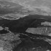
A farmstead comprising one partially roofed L-shaped building, four roofed buildings and three enclosures, and a lime kiln are depicted on the 1st edition of the OS 6-inch map (Aberdeenshire, 1869, sheet xci). Two roofed buildings and three enclosures are shown on the current edition of the OS 1:10000 map (1971).
Information from RCAHMS (SAH) 30 March 1999

