Pricing Change
New pricing for orders of material from this site will come into place shortly. Charges for supply of digital images, digitisation on demand, prints and licensing will be altered.
Upcoming Maintenance
Please be advised that this website will undergo scheduled maintenance on the following dates:
Thursday, 9 January: 11:00 AM - 3:00 PM
Thursday, 23 January: 11:00 AM - 3:00 PM
Thursday, 30 January: 11:00 AM - 3:00 PM
During these times, some functionality such as image purchasing may be temporarily unavailable. We apologise for any inconvenience this may cause.
Tullochgorum
Standing Stone (Prehistoric)
Site Name Tullochgorum
Classification Standing Stone (Prehistoric)
Alternative Name(s) Lagyie
Canmore ID 15446
Site Number NH92SE 6
NGR NH 9670 2101
NGR Description NH 9670 2101 and NH 9671 2102
Datum OSGB36 - NGR
Permalink http://canmore.org.uk/site/15446
- Council Highland
- Parish Duthil And Rothiemurchus
- Former Region Highland
- Former District Badenoch And Strathspey
- Former County Inverness-shire
NH92SE 6 9670 2101 and 9671 2102.
(NH 9670 2101) Standing Stone (NR)
OS 6"map, Inverness-shire, 2nd ed., (1903)
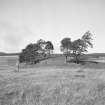
Two undressed stones of irregular form standing in a field on the N side of the N side of the River Spey. Traditionally Pictish.
Name Book 1871.
Two standing stones situated in a flat cultivated field with no evidence of associated structure. The E stone measures 2.3m high x 0.7 x 0.5m, the W 0.9m high x 1.1m x 0.4m.
Re-surveyed at 1/2500.
Visited by OS (N K B) 16 September 1966.
Field Visit (25 September 1943)
Standing stones, Lagyie.
About ¼ m SE of the chambered cairn [NH92SE 3] across the railway, and scarcely 400 yds SW of Tullochgoram farm, are two standing stones. The stones, standing on a line bearing 17 degrees S of W, occupy a very low gravel ridge on the flood-plain of the Spey well below the first gravel terrace and only 150 yds from the river bank. The E stone (triangular in plan) measures 2’9” high x 3’6” wide x 1’6” thick at its W edge. The W stone, which tapers upwards, measures 7’6” x 1’11” x 1’8” to 1’2”, its edge being also on the W.
Visited by RCAHMS (VGC, AG) 25 September 1943.
External Reference (2011)
Oram 1996 calls the site Lackie, Boat of Garten, and dates the stones to the Bronze Age.
Information from the ARCH Community Timeline Course, 2011


