Pricing Change
New pricing for orders of material from this site will come into place shortly. Charges for supply of digital images, digitisation on demand, prints and licensing will be altered.
Gallow Hill
Burial Ground (Period Unassigned), Execution Site (Post Medieval)
Site Name Gallow Hill
Classification Burial Ground (Period Unassigned), Execution Site (Post Medieval)
Alternative Name(s) Cholera Burial Ground
Canmore ID 15372
Site Number NH89SW 5
NGR NH 8025 9017
Datum OSGB36 - NGR
Permalink http://canmore.org.uk/site/15372
- Council Highland
- Parish Dornoch
- Former Region Highland
- Former District Sutherland
- Former County Sutherland
NH89SW 5 8025 9017.
(NH 8025 9017) Gallow Hill (NAT) Cholera Burial Ground (A.D. 1832)
OS 6" map, (1907)
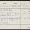
Gallow Hill - A small eminence being a natural feature covered with wood so called from its being at one time a place of execution. A little to the north of this hill is a small enclosure which was used as a burying ground in the year 1832 for the burial of persons dying of cholera.
Name Book 1873.
An upright stone pillar of rectangular section, 1.5m high, 0.5m wide and 0.2m thick at NH 8031 9019, is reputed locally to mark the site of the gallows. (Published as "post" on OS map.)
All that survives at the burial ground is one grave-stone dated 1833 at NH 8038 9021.
No enclosure wall is evident.
Visited by OS (A A) 23 March 1971.


