Pricing Change
New pricing for orders of material from this site will come into place shortly. Charges for supply of digital images, digitisation on demand, prints and licensing will be altered.
Edinburgh, Niddrie, Niddrie Mains Road, Niddrie Marischal Primary School
School (19th Century)
Site Name Edinburgh, Niddrie, Niddrie Mains Road, Niddrie Marischal Primary School
Classification School (19th Century)
Alternative Name(s) Niddrie Mill Primary School
Canmore ID 153321
Site Number NT37SW 471
NGR NT 30195 71816
Datum OSGB36 - NGR
Permalink http://canmore.org.uk/site/153321
First 100 images shown. See the Collections panel (below) for a link to all digital images.
- Council Edinburgh, City Of
- Parish Edinburgh (Edinburgh, City Of)
- Former Region Lothian
- Former District City Of Edinburgh
- Former County Midlothian
NT37SW 471.00 30195 71816
NT37SW 471.01 NT 30193 71799 Monument
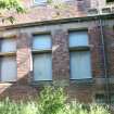
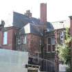
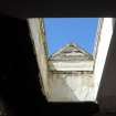
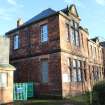
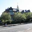
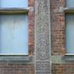
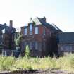
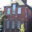
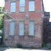
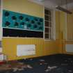
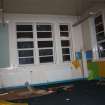
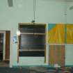
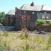
Brick built primary school in the Renaissance style situated immediately W of the Niddrie Burn. Slated roof with large slatted wooden lantern for bell, stone lintels at the windows and doors. On the second floor, moulded pediments above the windows, the room height extending into the roof. The architect was Robert Wilson.
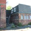
Later brick extensions with slated roofs at W and E ends and a wooden annexe to rear.
Annexe to rear burnt down over weekend 21st-22nd March 2009 and school now lies empty with all windows boarded up.
The school is depicted on the 1st Edition of the OS 25-inch map (Edinburghshire, 1895), which does not depict the monument. The monument first appears on the 2nd Edition (ibid, 1907-1908).
Information from RCAHMS (DE), March 2009.
Archaeological Evaluation (7 July 2014 - 9 July 2014)
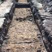
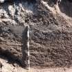
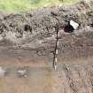
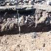
A programme of archaeological works that included trial trenching and historic building recording at Niddire Mill Primary School, Edinburgh.was undertaken in order to evaluate the site's archaeological potential and record the upstanding building prior to redevelopment. The proposed site takes in land that is considered to have some potential for early historic, medieval and post-medieval remains due to its location close to the Niddrie Burn. One undated linear ditch cut into the geological subsoil was recorded during the evaluation. A section excavated through this feature provided no datable material from which an indicative date and purpose could be gained. It may represent anything from a prehistoric or medieval ditch to the remains of a post-medieval or later water channel. The building assessment identified several phases of construction of the school building that had 19th century origins. A photographic record was also taken of a listed memorial cross that is located to the front of the school. A number of late 20th century brick foundation walls were recorded as part of the evaluation.
Information from Donald Wilson (Headland Archaeology) January 2015. OASIS ID - headland1-185936
Watching Brief (29 January 2015 - 30 June 2015)
Archaeological monitoring was carried out for the excavation of test pits, service trenches and the foundations of eight buildings during construction work at a residential development at Niddrie Primary School, Edinburgh. This work was carried out as a consequence of the results of an earlier archaeological evaluation and historic building recording.
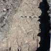
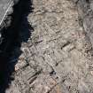
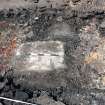
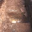
In addition to 20th century building remains, a couple of pits and a gully were recorded. No dating evidence was retrieved from these features but a pit and associated gully may be remains of a furnace associated with ironworking. Generally the features seem to be isolated structures, possibly peripheral to settlements lying outside the site boundaries.
Funder: CCG (Scotland) Ltd
Information from Magnar Dalland (Headland Archaeology) April 2016. OASIS ID: headland1-220402


![Trench 8. Section showing cut for ditch [024], facing NNE](http://i.rcahms.gov.uk/canmore/l/DP00271291.jpg)

![Trench 8. Pit [031] half sectioned, facing SE](http://i.rcahms.gov.uk/canmore/l/DP00271314.jpg)
![Trench 8. Pit [031] NW-facing section. Detail NE half, facing SE](http://i.rcahms.gov.uk/canmore/l/DP00271316.jpg)
![Trench 8. Pit [031] post-ex, facing S](http://i.rcahms.gov.uk/canmore/l/DP00271318.jpg)


![Building 4. Pit [036] (right) and gully [034] partly exposed, facing SE](http://i.rcahms.gov.uk/canmore/l/DP00271349.jpg)
![Building 4. Slot cut across gully [034], facing SW](http://i.rcahms.gov.uk/canmore/l/DP00271360.jpg)
![Building 4. Post-ex photo of pit [036], facing NE](http://i.rcahms.gov.uk/canmore/l/DP00271369.jpg)


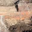
![Trench 8. Section showing W side of cut for ditch [024], facing NW](http://i.rcahms.gov.uk/canmore/l/DP00271286.jpg)
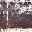
![Trench 8. Section showing W side of cut for ditch [024], facing NW](http://i.rcahms.gov.uk/canmore/l/DP00271288.jpg)
![Building 1. Fills (029) (background) and (030) (foreground) cut [028], facing SW](http://i.rcahms.gov.uk/canmore/l/DP00271293.jpg)


![Trench 8. Pit [031] location shot, facing S](http://i.rcahms.gov.uk/canmore/l/DP00271309.jpg)
![Trench 8. Pit [031] NW-facing section, facing SE](http://i.rcahms.gov.uk/canmore/l/DP00271315.jpg)


![Building 4. Pit [036] and gully [034] partly exposed, facing NE](http://i.rcahms.gov.uk/canmore/l/DP00271348.jpg)


![Trench 8. Photomerge of section showing cut for ditch [024], facing NW](http://i.rcahms.gov.uk/canmore/l/DP00271387.jpg)


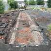
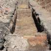
![View of ditch cut [016] in trench 4, facing N](http://i.rcahms.gov.uk/canmore/l/DP00271128.jpg)










![Trench 8. Section showing cut for ditch [024], facing NNE](http://i.rcahms.gov.uk/canmore/s/DP00271291.jpg)

![Trench 8. Pit [031] half sectioned, facing SE](http://i.rcahms.gov.uk/canmore/s/DP00271314.jpg)
![Trench 8. Pit [031] NW-facing section. Detail NE half, facing SE](http://i.rcahms.gov.uk/canmore/s/DP00271316.jpg)
![Trench 8. Pit [031] post-ex, facing S](http://i.rcahms.gov.uk/canmore/s/DP00271318.jpg)


![Building 4. Pit [036] (right) and gully [034] partly exposed, facing SE](http://i.rcahms.gov.uk/canmore/s/DP00271349.jpg)
![Building 4. Slot cut across gully [034], facing SW](http://i.rcahms.gov.uk/canmore/s/DP00271360.jpg)
![Building 4. Post-ex photo of pit [036], facing NE](http://i.rcahms.gov.uk/canmore/s/DP00271369.jpg)









![Trench 8. Section showing W side of cut for ditch [024], facing NW](http://i.rcahms.gov.uk/canmore/s/DP00271286.jpg)
![Trench 8. Section showing W side of cut for ditch [024], facing NW](http://i.rcahms.gov.uk/canmore/s/DP00271288.jpg)
![Building 1. Fills (029) (background) and (030) (foreground) cut [028], facing SW](http://i.rcahms.gov.uk/canmore/s/DP00271293.jpg)


![Trench 8. Pit [031] location shot, facing S](http://i.rcahms.gov.uk/canmore/s/DP00271309.jpg)
![Trench 8. Pit [031] NW-facing section, facing SE](http://i.rcahms.gov.uk/canmore/s/DP00271315.jpg)


![Building 4. Pit [036] and gully [034] partly exposed, facing NE](http://i.rcahms.gov.uk/canmore/s/DP00271348.jpg)


![Trench 8. Photomerge of section showing cut for ditch [024], facing NW](http://i.rcahms.gov.uk/canmore/s/DP00271387.jpg)



![View of ditch cut [016] in trench 4, facing N](http://i.rcahms.gov.uk/canmore/s/DP00271128.jpg)
