
Following the launch of trove.scot in February 2025 we are now planning the retiral of some of our webservices. Canmore will be switched off on 24th June 2025. Information about the closure can be found on the HES website: Retiral of HES web services | Historic Environment Scotland
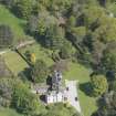
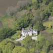
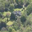
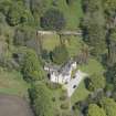
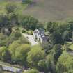
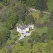
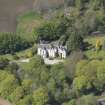
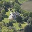
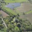
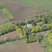
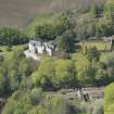
Corsindae, Walled Garden


Walled Garden (Period Unassigned)
Site Name Corsindae, Walled Garden
Classification Walled Garden (Period Unassigned)
Canmore ID 152445
Site Number NJ60NE 4.09
NGR NJ 68600 08809
Datum OSGB36 - NGR
Permalink http://canmore.org.uk/site/152445


- Council Aberdeenshire
- Parish Midmar
- Former Region Grampian
- Former District Gordon
- Former County Aberdeenshire
Rectangular, (?)18th-century, rubble-built walled garden whose west wall was lowered in 1840 to provide material for Smith's reconstruction of the house. Small, late 17th century sundial.
Taken from "Aberdeenshire: Donside and Strathbogie - An Illustrated Architectural Guide", by Ian Shepherd, 2006. Published by the Rutland Press http://www.rias.org.uk


