Raeburnfoot
Enclosure (Period Unassigned), Field Boundary(S) (Period Unassigned)
Site Name Raeburnfoot
Classification Enclosure (Period Unassigned), Field Boundary(S) (Period Unassigned)
Canmore ID 151289
Site Number NY29NE 98
NGR NY 2528 9958
Datum OSGB36 - NGR
Permalink http://canmore.org.uk/site/151289
- Council Dumfries And Galloway
- Parish Eskdalemuir
- Former Region Dumfries And Galloway
- Former District Annandale And Eskdale
- Former County Dumfries-shire
NY29NE 98 2510 9954
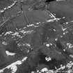
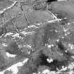
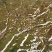
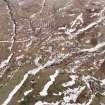
Oblique aerial photographs (RCAHMSAP 1996) have revealed the remains of a possible enclosure and field banks, 350m NW of Raeburnfoot farmsteading and immediately to the W of a bank barrow (NY29NE 75). The enclosure is roughly circular in shape with an internal diameter of about 50m. Three field banks, aligned NW-SE are visible to the E of the enclosure, one of them partly intersecting it, and they appear to be part of one field system. There are a number of other field banks in the surrounding area.
Information from RCAHMS (KJ) 19 November 1999.
Measured Survey (July 2005)
NY29NE 101 25000 99598
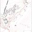
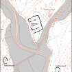
A field survey of the Roman Temporary Camp and adjacent later field boundaries (NY29NE 98) was undertaken by RCAHMS in July 2005.
Visited by RCAHMS (SPH, RHJ, PMcK) July 2005


