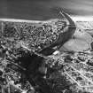
Nairn, Bridge Street, Town Bridge
Road Bridge (18th Century)
Site Name Nairn, Bridge Street, Town Bridge
Classification Road Bridge (18th Century)
Alternative Name(s) River Nairn
Canmore ID 15105
Site Number NH85NE 2
NGR NH 88605 56610
Datum OSGB36 - NGR
Permalink http://canmore.org.uk/site/15105
- Council Highland
- Parish Nairn
- Former Region Highland
- Former District Nairn
- Former County Nairn
NH85NE 2 88605 56610
For footbridge (downstream, to N), see NH85NE 463.
(NH 8860 5661) Nairn Br. (NAT)
OS 6" map, (1938).
REFERENCES
NATIONAL LIBRARY
Nattes Drawings - 1 drawing, 4th October, Vol.1, no.10
SCOTTISH RECORD OFFICE
Proposed new Bridge of Nairn.
Subscription list. Subscriptions have yielded ?736.16.6 Estimate ?12000
(Architect: ?George Burn) 1800
GD128/44/1
(Undated) information in NMRS.
Nairn Bridge was built in 1631 or 1632 and has sustained much damage from floods since then, particularly in 1868.
Name Book 1868.
A plaque on the north parapet of the present Nairn Bridge states that the bridge was built in 1803, partially re-erected in 1829 and 1868 and widened and strengthened in 1936. There is no definite evidence of 17th century structure about it.
Visited by OS (E G C) 29 November 1961.
(Location cited as NH 886 566). Nairn Bridge, built 1803, rebuilt 1829, 1868 and 1936. A three-span bridge with dressed-stone arch rings and rubble spandrels and wing-walls. There are oculi in the spandrels and a dentilated string course. The segmental arches decrease in span to the east.
J R Hume 1977.
Bridge, Bridge St. Built by George Burn, 1803, and reconstructed in 1829, 1868 and 1936.
J Gifford 1992.
This bridge carries the A96 (T) public road over the River Nairn on the eastern side of the town of Nairn.
The location assigned to this record defines the midpoint of the structure. The available map evidence indicates that it extends from NH c. 88591 56622 to NH c. 88622 56598.
Information from RCAHMS (RJCM), 23 March 2006.
Construction (1803)
Completed.
Construction (1829)
Partially destroyed in a flood.
R Paxton and J Shipway, 2007.
Construction (1868)
Town Bridge, Nairn
Rebuilt.
R Paxton and J Shipway, 2007.
Construction (1936)
Widened to 38 1/2 feet between parapets by F A MacDonald Partners (Glasgow).
R Paxton and J Shipway, 2007.
Publication Account (1999)
The ancient crossing point is still in daily use by the heavy traffic on the trunk road between Inverness and Aberdeen. The current Nairn Bridge figure 16 & 23, constructed by George Burn of Haddington, dates from 1803-4 and replaced one of 1631- 32 which fell into the river in 1794. An earlier structure, presumably wooden, may have existed from the thirteenth century when a burgess is described as Adam of the Bridge', but it is unclear as to what exactly this refers (seep 18). The present bridge has three unequal spans and has been repaired and widened several times, either after severe flooding (for example following the 1829 Moray Floods), or for practical reasons (as in 1936-7 when it was widened to cope better with motorised transport). The bridge could be said to mark the eastern extremity of the town, as it crosses the physical boundary of the river. The construction of Nairn Bridge in the seventeenth century meant easier communication for people and transport alike.
Information from - ‘Historic Nairn: The Archaeological Implications of Development’ (1999).
Publication Account (2007)
Town Bridge, Nairn
The Town Bridge, an asymmetrical triple-arch structure spanning the Nairn with its middle and western arches, was completed in 1803. It carries a roadway sloping from west to east and its width, since widening in 1936 under the direction of F. A. MacDonald and Partners (Glasgow) Ltd, is 3812 ft between parapets.
The bridge was designed and built by architect-engineer George Burn and exhibits the range of architectural details found on several of his other bridges, recessed arch-rings surmounted by archivolts, blind oculi, denticulated stringcourses, ashlar parapets and copings. The bridge was
partially destroyed in the great flood of 1829 and rebuilt soon afterwards, and again in 1868.
R Paxton and J Shipway, 2007.
Reproduced from 'Civil Engineering heritage: Scotland - Highlands and Islands' with kind permission from Thomas Telford Publishers.


