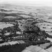
Southwick House
Country House (Mid 18th Century)
Site Name Southwick House
Classification Country House (Mid 18th Century)
Alternative Name(s) Southwick House Policies
Canmore ID 150363
Site Number NX95NW 40
NGR NX 93023 57461
Datum OSGB36 - NGR
Permalink http://canmore.org.uk/site/150363
- Council Dumfries And Galloway
- Parish Colvend And Southwick
- Former Region Dumfries And Galloway
- Former District Stewartry
- Former County Kirkcudbrightshire
NX95NW 40.00 93023 57461
NX95NW 40.01 NX 92952 57172 Stables
NX95NW 40.02 NX c. 92 57 Postman's house [unlocated]
NX95NW 40.03 NX 92854 57186 West Lodge
NX95NW 40.04 NX 93894 57026 East Lodge
NX95NW 40.05 NX 92987 57133 South Lodge
NX95NW 40.06 NX 92939 57188 Stables Cottage
NX95NW 40.07 NX 93384 58068 Burial-ground
NX95NW 40.08 NX 93686 56869 Home Farm
NX95NW 40.09 NX 93667 56930 Home Farm, Watermill
NX95NW 40.10 NX 93731 56834 Home Farm Cottages
NX95NW 40.11 NX 92946 57223 Walled Garden
See also:
NX95NW 5 NX 9365 5702 The Brough Motte
NX95NW 6 NX c. 93 57 Stone Circle [unlocated]
NX95NW 12 NX c. 93 57 Roman Temporary Camp [unlocated]
NX95NW 53 NX 9303 5718 Buildings [1st ed map]


