
Peterculter, Kennerty Bridge


Road Bridge (19th Century)
Site Name Peterculter, Kennerty Bridge
Classification Road Bridge (19th Century)
Alternative Name(s) Kennerty Road
Canmore ID 149887
Site Number NJ80SW 82
NGR NJ 83572 00553
Datum OSGB36 - NGR
Permalink http://canmore.org.uk/site/149887

- Council Aberdeen, City Of
- Parish Peterculter
- Former Region Grampian
- Former District City Of Aberdeen
- Former County Aberdeenshire
NJ80SW 82 83572 00553
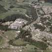
This bridge carries Kennerty Road (an unclassified public road) over the Culter Burn on the southern outskirts of Peterculter.
Information from RCAHMS (RJCM), 10 September 1999.

