Pricing Change
New pricing for orders of material from this site will come into place shortly. Charges for supply of digital images, digitisation on demand, prints and licensing will be altered.
Douglas Wood
Air Raid Shelter (Second World War), Building(S) (Second World War)
Site Name Douglas Wood
Classification Air Raid Shelter (Second World War), Building(S) (Second World War)
Alternative Name(s) The Brackens
Canmore ID 148613
Site Number NO44SE 46.01
NGR NO 4844 4115
NGR Description Centred NO 4844 4115
Datum OSGB36 - NGR
Permalink http://canmore.org.uk/site/148613
- Council Angus
- Parish Monikie
- Former Region Tayside
- Former District Angus
- Former County Angus
NO44SE 46.01 centred 4844 4115
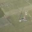
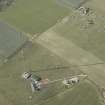
Four mast bases, some buildings and a sunken receiver/transmitter block are set within a rectangular enclosure at the W end of the radar station. The four mast bases are at NO 48399 41196, NO 48475 41188, NO 48415 41121 and NO 48491 41113 and the block is at NO 48444 41155.
The area is visible on vertical air photographs taken in 1947 (CPE/Scot/UK 304, 3079-3081, flown 26 September 1947), which show that at that date the masts were still standing. The air photographs also show that there was a single mast at c.NO 4863 4125, which would appear from the mapping evidence (OS 1:2500 scale digital map), to have been completely removed.
Information from RCAHMS (DE), October 2005
Field Visit (18 March 2021)
Pillbox Study Group record an air raid shelter at NO 4838 4117.
Information from Pillbox Study Group to HES 18 March 2021


