Kirkton
Field System (Period Unassigned), Hut Circle(S) (Prehistoric)
Site Name Kirkton
Classification Field System (Period Unassigned), Hut Circle(S) (Prehistoric)
Alternative Name(s) Mound Rock
Canmore ID 14767
Site Number NH79NE 26
NGR NH 789 991
Datum OSGB36 - NGR
Permalink http://canmore.org.uk/site/14767
- Council Highland
- Parish Golspie
- Former Region Highland
- Former District Sutherland
- Former County Sutherland
NH79NE 26 789 991.
(NH 792 991) Cairns (NR), (NH 794 992) Cairns (NR)
OS 6" map, (1960)
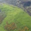
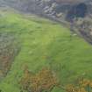
Centred at NH 789 990, on a S-facing hillside, is a settlement of 8 stone-walled huts (A-H), an enclosure (Z) and an associated field system.
Except for 'C' all the huts are circular. Hut 'H' is on a level shelf, the other huts are set into the slope.
Hut 'A' is visible as a platform, measuring c.7.5m in diameter, within a wall spread to c.2.5m on the N side increasing to c.4.6m on the S side. The entrance, in the ESE is mutilated.
'B' is visible as a platform measuring c.7.0m in diameter within a wall spread to c.3.0m all round. A gap in the ESE between the excavated and built up areas of the platform is probably the entrance.
'C' is visible as a platform, measuring c.7.5m NNW-ESE by 6.0m, bounded by a back scarp and a build up on the S. The platform continues towards the ESE for another 5.0m but this is probably due to mutilation. The entrance is not apparent.
'D' measures 13.0m in diameter between wall centres with the wall spread to c.3.0m all round. One or two outer facing stones are visible. The entrance is in the SSE.
'E' is visible as a platform, measuring c.6.5m in diameter, surrounded by traces of a wall. The entrance is not apparent.
'F' is visible as a platform, measuring c.7.5m in diameter, with traces of a wall around the S arc. The entrance is not apparent.
'G' is visible as a platform, measuring c.10.0m in diameter, surrounded by traces of a wall. Inner facing stones are visible in the N and one or two set stones in the S are probably the outer face, but there is insufficient for accurate internal or overall measurement. The entrance is not apparent.
About 30m to the SW of 'G', set into the slope and mutilated by a track on the NE side, is another platform measuring c.10.0m in diameter, but it is probably part of a cultivation terrace rather than a hut.
'H' meaures 8.5m in diameter internally within a wall 1.6m thick all round. The inner and outer wall face, of stones set on edge, is evident occasionally, except in the NE. The entrance is not apparent. Immediately to the NE of 'H' are the footings of a rectangular building measuring 7.0m by 3.5m.
'Z' is an oval enclosure, placed on the slope, defined by a single line of set stones, and measures 14.5m NNE-SSW by 11.0m. A gap in the NW side, c. 6.0m wide, is partially blocked by a stony mound, possibly a stone clearance heap.
The field system, best defined in the vicinity of 'A' consists of stone clearance heaps, (noted by the RCAHMS (1911) as half a dozen small mounds and by the Ordnance Survey Name Book (ONB, 1870) as tumuli and lynchets forming fields varying in size frm about 45m by 30m to about 20m by 10m. It is partially overlaid by recent cultivation.
Name Book 1870; RCAHMS 1911, visited 1909; Visited by OS (R L) 20 November 1969.
A-D and Z surveyed at 1/10,000.
E-H surveyed at 1/2500.
Visited by OS (J M) 6 May 1975.
NH 794 992 A watching brief was conducted on the installation of a telecommunications mast. Several prehistoric burial cairns and a souterrain were recorded near to the proposed mast site. All ground disturbance was monitored and no features or finds were recorded. (SUAT GS01).
Sponsor: Orange PCS Ltd.
N M Robertson 1998


