
Ferniehirst


Settlement (Period Unassigned)(Possible)
Site Name Ferniehirst
Classification Settlement (Period Unassigned)(Possible)
Canmore ID 147318
Site Number NT44SW 8
NGR NT 4454 4266
Datum OSGB36 - NGR
Permalink http://canmore.org.uk/site/147318


- Council Scottish Borders, The
- Parish Stow
- Former Region Borders
- Former District Ettrick And Lauderdale
- Former County Midlothian
NT44SW 8 4454 4266
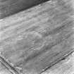
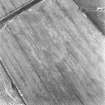
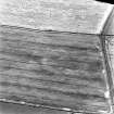
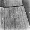
The faint cropmarks of a possible settlement have been revealed by oblique aerial photography (RCAHMSAP 1995) 900m N of Ferniehirst farmsteading. It is roughly circular in shape with an internal diameter of about 90-95m. There are a number of indeterminate cropmarks in the field including some in the interior of the settlement that may represent internal structures.
Information from RCAHMS (KJ) 14 July 1999.
Sbc Note
Visibility: This site is visible as a cropmark.
Information from Scottish Borders Council

