
Monk's Walk


Path (Period Unassigned)
Site Name Monk's Walk
Classification Path (Period Unassigned)
Canmore ID 14671
Site Number NH78NW 36
NGR NH 736 887
Datum OSGB36 - NGR
Permalink http://canmore.org.uk/site/14671


- Council Highland
- Parish Dornoch
- Former Region Highland
- Former District Sutherland
- Former County Sutherland
NH78NW 36 736 887.
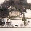
NH 736 887 'Monk's Walk' a pathway, where 'no doubt, in days long gone by, the monks who resided, in the castle were want to pace to and fro'. (Not named on 1st ed., OS 6" map, therefore probably a modern name).
W Calder 1949.
'Monks Walk' as described
Information from Lord Migdale, Ospisdale, Clashmore, Sutherland to OS.

