Pricing Change
New pricing for orders of material from this site will come into place shortly. Charges for supply of digital images, digitisation on demand, prints and licensing will be altered.
Upcoming Maintenance
Please be advised that this website will undergo scheduled maintenance on the following dates:
Thursday, 9 January: 11:00 AM - 3:00 PM
Thursday, 23 January: 11:00 AM - 3:00 PM
Thursday, 30 January: 11:00 AM - 3:00 PM
During these times, some functionality such as image purchasing may be temporarily unavailable. We apologise for any inconvenience this may cause.
Holywood
Field Boundary (Period Unassigned)(Possible), Rig And Furrow (Medieval) - (Post Medieval)
Site Name Holywood
Classification Field Boundary (Period Unassigned)(Possible), Rig And Furrow (Medieval) - (Post Medieval)
Canmore ID 146425
Site Number NX98SE 97
NGR NX 95689 80455
Datum OSGB36 - NGR
Permalink http://canmore.org.uk/site/146425
- Council Dumfries And Galloway
- Parish Holywood
- Former Region Dumfries And Galloway
- Former District Nithsdale
- Former County Dumfries-shire
NX98SE 97 95689 80455
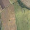
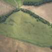
Oblique aerial photography (RCAHMSAP 1995) has revealed linear cropmarks and rig, 350m WNW of Holm farmsteading. A linear cropmark (NX c.9525 8040 to NX c.9543 8033), runs for about 200m WNW-ESE. A second linear feature (NX c.9554 8038 to NX c.9580 8044), aligned WSW-ENE and slighty curved, is visible for about 260m, and have been recorded 120m to the ENE. A patch of rig-and-furrow cultivation is visible in the SE corner of the field and runs for at least 100m SW-NE. A large number of other archaeological sites are recorded in the surrounding area (see NX98SE 42, NX98SE 68, NX98SE 86, NX98SE 81 ).
Information from RCAHMS (KJ) 1 July 1999.
What is probably a field boundary has been recorded as a cropmark on oblique aerial photography (RCAHMSAP 1995), extending for about 260m in two slight arcs. Rig and furrow is visible across much of the field.
Information from RCAHMS (BN) 29 April 2008


