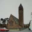
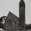
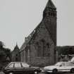
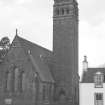
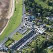
Arran, Lamlash, Shore Road, Lamlash And Kilbride Parish Church
Church (18th Century) - (19th Century) (1773), Church (19th Century) (1886)
Site Name Arran, Lamlash, Shore Road, Lamlash And Kilbride Parish Church
Classification Church (18th Century) - (19th Century) (1773), Church (19th Century) (1886)
Alternative Name(s) Kilbride Parish Kirk
Canmore ID 146066
Site Number NS03SW 50
NGR NS 02569 30939
Datum OSGB36 - NGR
Permalink http://canmore.org.uk/site/146066
- Council North Ayrshire
- Parish Kilbride
- Former Region Strathclyde
- Former District Cunninghame
- Former County Buteshire
NS03SW 50 02569 30939
Kilbride Parish Kirk [NAT]
OS (GIS) MasterMap, June 2010.
For cross emplaced in front of church [cited location: NS03SW 41 0256 3093], see NS03SW 41.
NS 0256 3093 Site identified as part of a coastal zone assessment survey.
M Cressey and S Badger 2005.
NMRS REFERENCE
Architect: F. T. Pilkington 1871 (Not executed)
Designed by H. & D. Barclay - 1886.
NMRS Microfilm & Microfiche Collection
Monumental Inscriptions within Cunninghame District
Copyright: Cunninghame District Council
Acc. no. 1990/57
Reels 1 & 2 (Arran), accompanied by index on micofiche
(Undated) information in NMRS.
Note
T-shaped church depicted on the 1st edition of the 25-inch OS map (1867). This building is replaced to the west by a new cruciform building, labeled "Church" on the 2nd edition (1896).
Information from HES (C. DeDeo) 20 January 2025


