
Pricing Change
New pricing for orders of material from this site will come into place shortly. Charges for supply of digital images, digitisation on demand, prints and licensing will be altered.
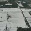
Blackstand


Mound (Period Unassigned)
Site Name Blackstand
Classification Mound (Period Unassigned)
Canmore ID 14538
Site Number NH76SW 7
NGR NH 7144 6072
Datum OSGB36 - NGR
Permalink http://canmore.org.uk/site/14538


- Council Highland
- Parish Cromarty
- Former Region Highland
- Former District Ross And Cromarty
- Former County Ross And Cromarty
NH76SW 7 7144 6072.
(NH 7144 6072) This is an oval mound 120' by 90' and approximately 7' high.It is overgrown with gorse and broom.
Miss Henshall considers it more likely to be natural than artificial.
A A Woodham 1956; Information from A A Woodham to OS; A S Henshall 1963.
A large mound situated in a forestry plantation.
Visited by OS (N K B) 21 January 1966.

