
Pricing Change
New pricing for orders of material from this site will come into place shortly. Charges for supply of digital images, digitisation on demand, prints and licensing will be altered.
Navity


Cairnfield(S) (Prehistoric)
Site Name Navity
Classification Cairnfield(S) (Prehistoric)
Alternative Name(s) Moor Of Navity
Canmore ID 14515
Site Number NH76SE 2
NGR NH 7734 6473
NGR Description Centred on NH 7734 6473
Datum OSGB36 - NGR
Permalink http://canmore.org.uk/site/14515


- Council Highland
- Parish Cromarty
- Former Region Highland
- Former District Ross And Cromarty
- Former County Ross And Cromarty
NH76SE 2 773 648.
The Ordnance Survey Name Book (ONB, 1871) describes cairns (not published on 1st ed., OS 6"map) in the vicinity of enclosure NH76SE 3 as generally measuring 2' high, 21' long, and 12' broad, all oriented N-S and grass-covered in heather. Woodham (1956) notes a group of eight round cairns at NH 779 653, varying from 20' - 36' in diameter and 6" - 1 1/2' high, and adds that individual small cairns occur all over the Moor of Navity.
Name Book 1871; A A Woodham 1956.
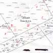
Centred at NH 773 648 along the summit of a broad ridge are at least 20 stony mounds of different shapes and sizes, the largest being about 12.0m in diameter. They occur mainly in rough grazing and have been ploughed down, but several survive in virgin moorland and appear to be stone clearance heaps of the type usually associated with hut circles. There are also a few isolated examples on the moor to the W, but no huts or cultivation plots are evident.
Visited by OS (A A) 6 January 1971.
Field Visit (24 August 1943)
This site was included within the RCAHMS Emergency Survey (1942-3), an unpublished rescue project. Site descriptions, organised by county, vary from short notes to lengthy and full descriptions and are available to view online with contemporary sketches and photographs. The original typescripts, manuscripts, notebooks and photographs can also be consulted in the RCAHMS Search Room.
Information from RCAHMS (GFG) 10 December 2014.
Field Visit (May 1979)
Navity NH 779 653 and NH76NE 12 and NH76SE 2
Nothing now remains in an area of arable fields and improved pasture of a group of small cairns noted by the RCAMS in 1943; a 'couple of score' cairns then stood uphill from the enclosures NH76NE 4, NH76NE 5 and NH76NE 3.
RCAHMS 1979, visited May 1979
MS notes in NMRS, RCAMS Emergency Surveys; Woodham 1956, 80, no. 39

