
Pricing Change
New pricing for orders of material from this site will come into place shortly. Charges for supply of digital images, digitisation on demand, prints and licensing will be altered.
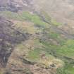
Kilmory


Church (Period Unassigned), Head Dyke (Post Medieval), Lime Kiln (Period Unassigned), School (Period Unassigned), Township (Period Unassigned)
Site Name Kilmory
Classification Church (Period Unassigned), Head Dyke (Post Medieval), Lime Kiln (Period Unassigned), School (Period Unassigned), Township (Period Unassigned)
Canmore ID 145124
Site Number NM57SW 10
NGR NM 529 701
NGR Description Centred on NM 529 701
Datum OSGB36 - NGR
Permalink http://canmore.org.uk/site/145124

- Council Highland
- Parish Ardnamurchan
- Former Region Highland
- Former District Lochaber
- Former County Argyll
NM57SW 10 centred on 529 701
See also:
NM56NW 1 NM 5312 6998 Chapel; Burial Ground; Font; Cross-head
A township comprising three unroofed buildings, one of which is a long building of three compartments, two partially roofed buildings, twenty-five roofed buildings, one of which is a long L-shaped building, one is annotated as a School and another is annotated as a Church, four enclosures, a lime kiln and a head-dyke is depicted on the 1st edition of the OS 6-inch map (Argyllshire 1875, sheet xv). Ten unroofed, nineteen roofed buildings, which include a Schoolhouse, a Church and a Hall, three enclosures and part of the head-dyke are shown on the current edition of the OS 1:10000 map (1974).
Information from RCAHMS (SAH) 22 April 1998

