
Jerah


Shieling Hut(S) (Medieval) - (Post Medieval)
Site Name Jerah
Classification Shieling Hut(S) (Medieval) - (Post Medieval)
Canmore ID 145021
Site Number NS89NW 63.05
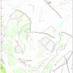
NGR NS 8467 9976
Datum OSGB36 - NGR
Permalink http://canmore.org.uk/site/145021

- Council Stirling
- Parish Logie (Stirling)
- Former Region Central
- Former District Stirling
- Former County Stirlingshire
Field Visit (4 June 1997)
NS89NW 63.05 8467 9976
The grass-grown, turf footings of four subrectangular buildings, probably shieling-huts, are situated at the ENE end of an intake of the field-system (NS89NW 63.02) around Jerah (NS89NW 63.01). Three of the buildings (MENS97 118, 120, 121) were clearly enough defined to be measured internally; two are similar in size at 6.3m by 3m (MENS97 120) and 6.2m by 2.6m (MENS97 121). The third building (MENS97 118) is larger at 11m by 3.7m, and is divided into two compartments. The fourth building (MENS97 119) lies in a gateway through the modern fence. It has been reduced to a low subrectangular mound, measuring 10.4m in length by 6.1m in breadth over a low bank.
(MENS97 118-21)
Visited by RCAHMS (DCC) 4 June 1997

