
Pricing Change
New pricing for orders of material from this site will come into place shortly. Charges for supply of digital images, digitisation on demand, prints and licensing will be altered.
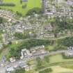
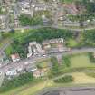
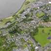
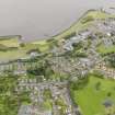
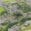
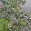
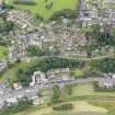
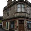
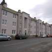
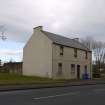
Bo'ness, Corbiehall, General


General View (Period Unassigned)
Site Name Bo'ness, Corbiehall, General
Classification General View (Period Unassigned)
Canmore ID 144261
Site Number NS98SE 112
NGR NS 99425 81383
Datum OSGB36 - NGR
Permalink http://canmore.org.uk/site/144261


- Council Falkirk
- Parish Bo'ness And Carriden
- Former Region Central
- Former District Falkirk
- Former County West Lothian
Characterisation
This site falls within the Corbiehall and Snab Area of Townscape Character (NS98SE 207), which was defined as part of the RCAHMS Urban Survey Programme 2013. Text relating to the historical development and topography, and present character of the Corbiehall and Snab Area of Townscape Character can be viewed at site NS98SE 207.
Information from RCAHMS (LK), January 2014

