|
Photographs and Off-line Digital Images |
C 46802 |
RCAHMS Aerial Photography |
Ironshill, oblique aerial view, taken from the NW, centred on the cropmarks of an enclosure, pits and linear cropmarks. A field boundary is visible in the top left-hand corner of the photograph. |
7/1995 |
Item Level |
|
|
Photographs and Off-line Digital Images |
C 46803 |
RCAHMS Aerial Photography |
Ironshill, oblique aerial view, taken from the WNW, centred on the cropmarks of an enclosure, pits and linear cropmarks. A field boundary is visible in the top right-hand corner of the photograph. |
4/7/1995 |
Item Level |
|
|
Photographs and Off-line Digital Images |
C 72259 |
RCAHMS Aerial Photography |
Newbarns Smithy, oblique aerial view, taken from the ENE, centred on cropmarks including those of an unenclosed settlement and a field boundary. Further cropmarks are visible in the bottom half of the photograph. |
8/7/1996 |
Item Level |
|
|
Photographs and Off-line Digital Images |
C 72260 |
RCAHMS Aerial Photography |
Newbarns Smithy, oblique aerial view, taken from the NNE, centred on cropmarks including those of an unenclosed settlement and a field boundary. Further cropmarks are visible in the centre left of the photograph. |
8/7/1996 |
Item Level |
|
|
Photographs and Off-line Digital Images |
C 72261 |
RCAHMS Aerial Photography |
Newbarns Smithy, oblique aerial view, taken from the ESE, centred on cropmarks including those of an unenclosed settlement and a field boundary. Further cropmarks are visible in the bottom half of the photograph. |
8/7/1996 |
Item Level |
|
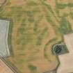 |
On-line Digital Images |
DP 166884 |
RCAHMS Aerial Photography Digital |
Oblique aerial view of the cropmarks of the unenclosed and palisaded settlements, enclosures and pits, looking WSW. |
18/7/2013 |
Item Level |
|
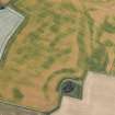 |
On-line Digital Images |
DP 166885 |
RCAHMS Aerial Photography Digital |
Oblique aerial view of the cropmarks of the unenclosed and palisaded settlements, enclosures, linear features and pits, looking SW. |
18/7/2013 |
Item Level |
|
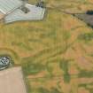 |
On-line Digital Images |
DP 166886 |
RCAHMS Aerial Photography Digital |
Oblique aerial view of the cropmarks of the unenclosed and palisaded settlements, enclosures, linear features and pits, looking SSE. |
18/7/2013 |
Item Level |
|
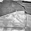 |
On-line Digital Images |
SC 1721264 |
RCAHMS Aerial Photography |
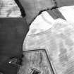
Ironshill, oblique aerial view, taken from the NW, centred on the cropmarks of an enclosure, pits and linear cropmarks. A field boundary is visible in the top left-hand corner of the photograph. |
7/1995 |
Item Level |
|
 |
On-line Digital Images |
SC 1721421 |
RCAHMS Aerial Photography |
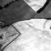
Newbarns Smithy, oblique aerial view, taken from the ENE, centred on cropmarks including those of an unenclosed settlement and a field boundary. Further cropmarks are visible in the bottom half of the photograph. |
8/7/1996 |
Item Level |
|
 |
On-line Digital Images |
SC 1721422 |
RCAHMS Aerial Photography |
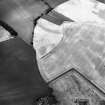
Newbarns Smithy, oblique aerial view, taken from the NNE, centred on cropmarks including those of an unenclosed settlement and a field boundary. Further cropmarks are visible in the centre left of the photograph. |
8/7/1996 |
Item Level |
|
 |
On-line Digital Images |
SC 1721423 |
RCAHMS Aerial Photography |
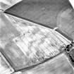
Newbarns Smithy, oblique aerial view, taken from the ESE, centred on cropmarks including those of an unenclosed settlement and a field boundary. Further cropmarks are visible in the bottom half of the photograph. |
8/7/1996 |
Item Level |
|
 |
On-line Digital Images |
SC 1721562 |
RCAHMS Aerial Photography |
Ironshill, oblique aerial view, taken from the WNW, centred on the cropmarks of an enclosure, pits and linear cropmarks. A field boundary is visible in the top right-hand corner of the photograph. |
4/7/1995 |
Item Level |
|


