
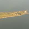
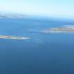
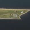
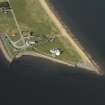
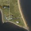
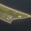
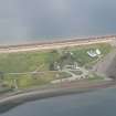
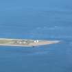
Chanonry Point, Cottage


Cottage (Period Unassigned)
Site Name Chanonry Point, Cottage
Classification Cottage (Period Unassigned)
Alternative Name(s) Chanonry Ness
Canmore ID 14374
Site Number NH75NW 54
NGR NH 7482 5572
Datum OSGB36 - NGR
Permalink http://canmore.org.uk/site/14374


- Council Highland
- Parish Rosemarkie
- Former Region Highland
- Former District Ross And Cromarty
- Former County Ross And Cromarty
NH75NW 54 7482 5572.
Cottage - visited.
19th century or earlier.
CFA/MORA Coastal Assessment Survey 1998.
Photographic Survey (July 1961)
Photographs of buildings at Chanonry Point, Ross and Cromarty, by the Scottish National Buildings Record in 1961.

