
Allanfearn


Cropmark(S) (Prehistoric), Enclosure (Prehistoric), Pit Setting (Prehistoric), Settlement (Prehistoric)
Site Name Allanfearn
Classification Cropmark(S) (Prehistoric), Enclosure (Prehistoric), Pit Setting (Prehistoric), Settlement (Prehistoric)
Alternative Name(s) Balloch Of Culloden
Canmore ID 14220
Site Number NH74NW 31
NGR NH 72067 47521
Datum OSGB36 - NGR
Permalink http://canmore.org.uk/site/14220


- Council Highland
- Parish Inverness And Bona
- Former Region Highland
- Former District Inverness
- Former County Inverness-shire
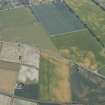
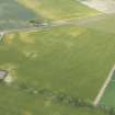
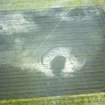
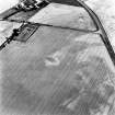
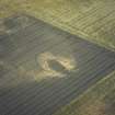
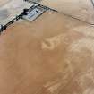
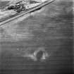
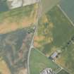
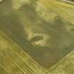
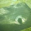
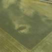
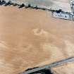
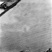
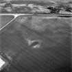
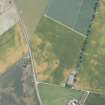
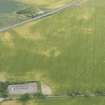
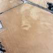
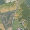
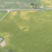
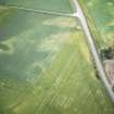
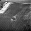
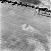
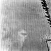
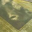
A roughly oval cropmark visible on aerial photographs, measuring about 25m to 30m in length, lies within the enclosure and intersects it on the SW side and it is surrounded by a pit-setting.
Information from RCAHMS (KJ), 22 October 1999.
Information to follow.
RCAHMS (KB), 26 June 2000.
Note (1979)
Allanfearn NH 7203 4753 NH74NW 31
NH 720 475. Air photography have revealed the crop-mark of an almost circular enclosure 450m ENE of Allanfearn farmhouse. It measures about 43m in diameter within a single ditch. Visible on RCAHMS AP 1976.
RCAHMS 1979.

