Following the launch of trove.scot in February 2025 we are now planning the retiral of some of our webservices. Canmore will be switched off on 24th June 2025. Information about the closure can be found on the HES website: Retiral of HES web services | Historic Environment Scotland
Culloden Moor, Cumberland's Stone
Stone (Period Unassigned)
Site Name Culloden Moor, Cumberland's Stone
Classification Stone (Period Unassigned)
Alternative Name(s) Culloden Muir, Duke Of Cumberland's Stone
Canmore ID 14202
Site Number NH74NW 17.01
NGR NH 7497 4526
Datum OSGB36 - NGR
Permalink http://canmore.org.uk/site/14202
- Council Highland
- Parish Croy And Dalcross (Inverness)
- Former Region Highland
- Former District Inverness
- Former County Inverness-shire
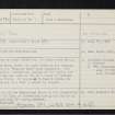
NH74NW 17.01 7497 4526.
(NH 7497 4526) Cumberland's Stone (NAT)
OS 6" map, Inverness-shire, 2nd ed., (1906).
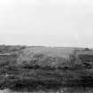
According to local tradition, the Cumberland Stone, near Culloden Moor, marks the spot where on the morning of the battle the "Butcher Duke" took breakfast. The huge conglomerate served the purpose of his table, and later in the day was used by him as a coign of vantage to survey the field. It measures 53 feet 6 inches in circumference and is 5 feet 3 inches in height.
Information from Aberdeen Journal, 1909, 2, 132-3 and The Scotsman, 27 April 1909.
On the top of the Cumberland Stone is the inscription 'Position of the Duke of Cumberland during the Battle of Culloden'.
Visited by OS (W D J) 24 April 1962.
Removed from list of scheduled ancient monuments, former number 965.
Information from Historic Scotland, 14 November 1996.
Photogrammetric Survey (28 October 2021)
NH 7497 4526 As part of other fieldwork at Culloden the opportunity was taken to visit Cumberland’s Stone (Canmore ID: 14202), on 28 October 2021, and to capture digital imagery which was then used to produce a 3D model of the stone using Agisoft Metashape. The model will be uploaded to SketchFab. The text reads ‘Position of the Duke of Cumberland during the Battle of Culloden’.
Archive: NTS SMR and NRHE (intended) Funder: The National Trust for Scotland


