
Following the launch of trove.scot in February 2025 we are now planning the retiral of some of our webservices. Canmore will be switched off on 24th June 2025. Information about the closure can be found on the HES website: Retiral of HES web services | Historic Environment Scotland
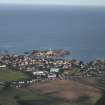
Boddam, Stirling Hill, Raf Buchan, Domestic Site


Barracks (20th Century), House(S) (20th Century)
Site Name Boddam, Stirling Hill, Raf Buchan, Domestic Site
Classification Barracks (20th Century), House(S) (20th Century)
Alternative Name(s) Stirling Hill, Radar Station; Accommodation Area
Canmore ID 141942
Site Number NK14SW 71.01
NGR NK 1300 4205
NGR Description Centred NK 1300 4205
Datum OSGB36 - NGR
Permalink http://canmore.org.uk/site/141942

- Council Aberdeenshire
- Parish Peterhead
- Former Region Grampian
- Former District Banff And Buchan
- Former County Aberdeenshire
NK14SW 71.01 centred 1300 4205

