
Following the launch of trove.scot in February 2025 we are now planning the retiral of some of our webservices. Canmore will be switched off on 24th June 2025. Information about the closure can be found on the HES website: Retiral of HES web services | Historic Environment Scotland
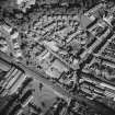
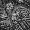
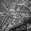
Kirkcaldy, Dunnikier Road, St Marie's Roman Catholic Church


Church (20th Century), War Memorial (20th Century)
Site Name Kirkcaldy, Dunnikier Road, St Marie's Roman Catholic Church
Classification Church (20th Century), War Memorial (20th Century)
Alternative Name(s) Free Church; Victoria Road: War Memorial
Canmore ID 141593
Site Number NT29SE 282
NGR NT 28194 92332
Datum OSGB36 - NGR
Permalink http://canmore.org.uk/site/141593


- Council Fife
- Parish Kirkcaldy And Dysart
- Former Region Fife
- Former District Kirkcaldy
- Former County Fife
NT29SE 282 28194 92332
St Marie's RC Church [NAT]
OS (GIS) MasterMap, November 2009.

