
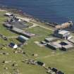
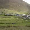
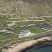
St Kilda, Hirta, Village Bay, Factor's House


Communications Station (First World War), Drain (19th Century), House (19th Century), Radio Mast(S) (First World War)
Site Name St Kilda, Hirta, Village Bay, Factor's House
Classification Communications Station (First World War), Drain (19th Century), House (19th Century), Radio Mast(S) (First World War)
Canmore ID 140730
Site Number NF19NW 21.45
NGR NF 10307 99240
Datum OSGB36 - NGR
Permalink http://canmore.org.uk/site/140730


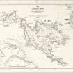
- Council Western Isles
- Parish Harris
- Former Region Western Isles Islands Area
- Former District Western Isles
- Former County Inverness-shire
NF19NW 21.45 10307 99240
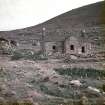
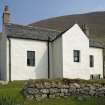
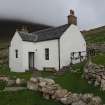
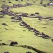
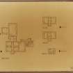
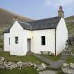
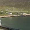
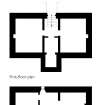
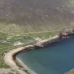
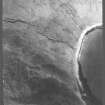
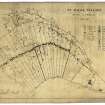
The Factor's House probably dates to the later half of the 19th century and was occupied by the factor when he came to Hirta to collect the rents. The building also provided accommodation for the schoolteacher and the nurse, as well as the more notable visitors to the island. The building is set into sloping ground immediately to the N of The Street and is built over two storeys with a slate roof and chimneys in both gable-ends. Each storey could have functioned independently, with access to the ground-floor provided by a projecting porch, and access to the upper floor gained at the rear by a flight of internal stairs.
Information from RCAHMS (ARG) 16 June 2008
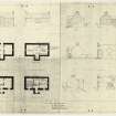
Conservation (June 2012 - July 2012)
Refurbishment of the Factor's House was undertaken between June and July 2012.
NTS 2012
Watching Brief (9 June 2017)
NF 10321 99217 (NF19NW 21.45) A watching brief was undertaken, 9 June 2017, during remedial works to a 19th-century drain running under the street 19.5m SE of the Factor’s House. Excavation revealed a stone-lined drain with capstones covering a naturally accrued fill of earth very similar to surrounding topsoil. This fill was removed to clear the drain and the capstones were restored to their original location.
Report: National Trust for Scotland and NRHE
Funder: National Trust for Scotland
Craig Stanford – National Trust for Scotland
(Source: DES, Volume 18)

