
St Cyrus, Scotston Of Kirkside, Chain Home Low Radar Station


Radar Station (20th Century)
Site Name St Cyrus, Scotston Of Kirkside, Chain Home Low Radar Station
Classification Radar Station (20th Century)
Canmore ID 138975
Site Number NO76SW 74
NGR NO 7419 6407
Datum OSGB36 - NGR
Permalink http://canmore.org.uk/site/138975


- Council Aberdeenshire
- Parish St Cyrus
- Former Region Grampian
- Former District Kincardine And Deeside
- Former County Kincardineshire
NO76SW 74.00 7419 6407
NO76SW 74.01 NO c.7401 6399 and NO c.7420 6402 Pillboxes
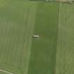
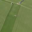
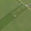
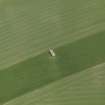
A Chain Home Low radar station is situated some 300m ENE of Scotston of Kirkside farm. The transmitter/receiver block is located at NO 7419 6407 and is depicted on the current edition of the chart copy OS 1:10000 map (1976).
Information from Mr I Brown, November 1998
The radar station is visible on a oblique wartime air photograph (772.H61, 4.10, flown 1942). The radar station is situated in cultivated fields to the ENE of Scotston of Kirkside farm. A series of wooden buildings, Nissen huts, with at least one earth covered bunker possibly for the electricity generator and two pillboxes are visible within a perimeter fence.
Information from RCAHMS (DE) March 2000

