Dunkeld - Dalnacardoch - Ruthven - Aviemore - Inverness Military Road
Military Road (18th Century)
Site Name Dunkeld - Dalnacardoch - Ruthven - Aviemore - Inverness Military Road
Classification Military Road (18th Century)
Alternative Name(s) Dalwhinnie Distillery
Canmore ID 138920
Site Number NN68NW 8
NGR NN 6375 8500
NGR Description NN 6375 8500 to NN 6499 8728
Datum OSGB36 - NGR
Permalink http://canmore.org.uk/site/138920
- Council Highland
- Parish Laggan
- Former Region Highland
- Former District Badenoch And Strathspey
- Former County Inverness-shire
NN68NW 7 6375 8500 to 6499 8728 MR 2 (Formerly Lin 501 [part of]).
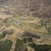
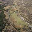
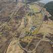
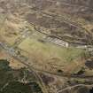
A short stretch of the Wade road remains at the N end of Dalwhinnie village, just beyond the distillery, at 641 857. Instead of bearing left, the military road is visible heading straight on, crossing a rubbish tip and joining the A9 approximately half a mile further on, having traversed the railway line. It then mainly follows the line of the modern road. The junction with the Wade road to Fort Augustus via the Corrieyairack Pass (MR 4) lies in this area, this road going off to the left about one mile beyond the Loch Ericht Hotel, but its exact location cannot be determined.
J B Salmond 1938; W Taylor 1976; J and A Baker 1982.
NN 6375 8500 to NN 6410 8560 modern road on line of Wade's road.
NN 6410 8560 to NN 6431 8614 disused track on line of Wade's road.
NN 6431 8614 to NN 6499 8728 modern road on line of Wade's road.
Visited by OS February 1979.
Heading N from Dalwhinnie distillery, the military road follows a recently resurfaced gravel track, no 18th century remains being visible. Stretches of recent plant damage and a section of recently built-up banking occur on the E side of the track, which later passes a series of filter beds. As it crosses the railway line to re-join the modern tarmac road a short section of heather covered track between banks can be seen. It is then believed to follow the modern road, which has obliterated any remains of the Wade road.
M Logie (Highland Council) 1997; NMRS MS/1007/2.


