Drummond Castle
Garden Wall (Period Unassigned)
Site Name Drummond Castle
Classification Garden Wall (Period Unassigned)
Alternative Name(s) Drummond Castle Policies
Canmore ID 138052
Site Number NN81NW 2.02
NGR NN 843 179
Datum OSGB36 - NGR
Permalink http://canmore.org.uk/site/138052
- Council Perth And Kinross
- Parish Muthill
- Former Region Tayside
- Former District Perth And Kinross
- Former County Perthshire
NN81NW 2.02 843 179
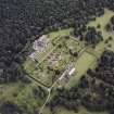
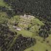
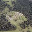
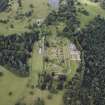
NN 843 179 Machine and hand excavations beside the western boundary wall of the formal gardens show that the base wall has been partly buried by soil accumulation, and originally stood at the foot of a gentle but substantial slope, functioning in effect as a ha-ha. The excavation also revealed two spurious wall foundations, in fact natural glacial features, composed of iron-rich green sandstone rubble. The sandstone delaminates in curved sheets resembling prehistoric pottery, adding a further trap for the unwary.
Sponsor: Drummond Castle Trust.
D Bowler 1997


