
Lewis, Linshader


Farmstead (Period Unassigned), Head Dyke(S) (Post Medieval), Township (Period Unassigned), Township (Period Unassigned)
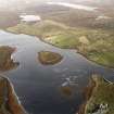
Site Name Lewis, Linshader
Classification Farmstead (Period Unassigned), Head Dyke(S) (Post Medieval), Township (Period Unassigned), Township (Period Unassigned)
Alternative Name(s) Collavig
Canmore ID 137372
Site Number NB23SW 48
NGR NB 2080 3190
NGR Description Centred on NB 2080 3190
Datum OSGB36 - NGR
Permalink http://canmore.org.uk/site/137372

- Council Western Isles
- Parish Uig
- Former Region Western Isles Islands Area
- Former District Western Isles
- Former County Ross And Cromarty
Note
A township, comprising one roofed building, fourteen unroofed buildings and eleven enclosures is depicted on the 1st edition of the OS 6-inch map (Island of Lewis, Ross-shire 1853, sheet 25). The township appears to have been cleared for the farm of Linshader which is also shown as six roofed buildings, three of which surround a courtyard at NB 2108 3195. In addition, an extensive system of head-dykes (NB 213 306 to NB 194 313), which lies to S and W of the township and is conjoined with the head-dyke systems to the S (NB22NW 23) and to the W (NB13SE 49).
The farmstead was in turn replaced by a scattered crofting township, comprising sixteen roofed buildings, one of which is a church, and eight unroofed buildings as shown on the current edition of the OS 1:10000 map (1974). Some lengths of head-dyke are also marked.
Information from RCAHMS (AKK) 29 September 1997.

