
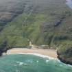
Lewis, Dalmore


Township (Period Unassigned)
Site Name Lewis, Dalmore
Classification Township (Period Unassigned)
Canmore ID 137272
Site Number NB24SW 32.04
NGR NB 2190 4470
NGR Description From NB 2187 4504 to NB 2205 4414
Datum OSGB36 - NGR
Permalink http://canmore.org.uk/site/137272

- Council Western Isles
- Parish Barvas
- Former Region Western Isles Islands Area
- Former District Western Isles
- Former County Ross And Cromarty
Note
A crofting township, comprising fourteen roofed buildings, one unroofed building, ten unroofed structures and seven enclosures is depicted on the 1st edition of the OS 6-inch map (Island of Lewis, Ross-shire 1853, sheet 12) laid out along a road. This township was cleared c.1853 to enlarge Dalbeag farm and is shown as completely abandoned on the 2nd edition of the OS 6-inch map (Island of Lewis, Ross-shire 1897, sheet 12).
Information from RCAHMS (AKK) 18 September 1997.

