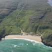
Lewis, Dalmore
Building (Post Medieval), Church (19th Century)
Site Name Lewis, Dalmore
Classification Building (Post Medieval), Church (19th Century)
Alternative Name(s) Dalemore
Canmore ID 137271
Site Number NB24SW 32.03
NGR NB 2174 4475
Datum OSGB36 - NGR
Permalink http://canmore.org.uk/site/137271
- Council Western Isles
- Parish Barvas
- Former Region Western Isles Islands Area
- Former District Western Isles
- Former County Ross And Cromarty
Field Visit (28 June 1914)
Church, Dalemore.
This church, near the shore end of a valley about 1 1/2 miles north-west of the eighth milestone on the road from Callanish to Barvas, is of comparatively recent date. It is an ordinary structure with no features of interest.
RCAHSM 1928, visited 28 June 1914
OS map ref, Lewis xii
Note (18 September 1997)
NB24SW 32.03 2174 4475
One unroofed building annotated as Dalmore Church (in ruins) and a further small unroofed building are depicted on the 1st edition of the OS 6-inch map (Island of Lewis, Ross-shire 1853, sheet 12). One roofed building and two enclosures are shown on the current edition of the OS 1:10000 map (1975).
Information from RCAHMS (AKK) 18 September 1997.
Note (4 November 2020)
The church is described by the OS as 'An old church in ruins, which belonged to the established church of Scotland, it was built about the year 1810 as a chapel of ease, the walls are about 6 ft high and composed of lime and stones' (Name Book, Ross and Cromarty (insular), No. 26, p.74).
Information from HES Survey and Recording (GFG) 4 November 2020.


