Mid Brae
Chambered Cairn (Neolithic)
Site Name Mid Brae
Classification Chambered Cairn (Neolithic)
Alternative Name(s) Easter Brae
Canmore ID 13690
Site Number NH66SE 4
NGR NH 66153 62814
Datum OSGB36 - NGR
Permalink http://canmore.org.uk/site/13690
- Council Highland
- Parish Resolis
- Former Region Highland
- Former District Ross And Cromarty
- Former County Ross And Cromarty
NH66SE 4 6615 6281.
(NH 6615 6281) Long Cairn (NR)
OS 6" map, (1959)
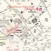
This long cairn, composed of large stones, has been severely robbed and is surrounded and mutilated by the foundations of old crofts.
The cairn, oriented ENE-WSW, is about 230' long and 40' to 50' wide, although its exact extent is difficult to determine. Its rectangular Orkney-Cromarty type chamber is partly exposed at the west end of the cairn; and two large slabs and a small earthfast stone at the east end suggest that there may have been a second chamber.
A S Henshall 1963, visited 9 July 1956.
A whin-covered, chambered long cairn as described by Henshall. Insufficient evidence to support second chamber theory.
Resurveyed at 1/2500
Visited by OS (N K B) 27 January 1966.
No change to previous field report.
Surveyed at 1:10 000.
Visited by OS (J B) 11 January 1978.
Field Visit (25 August 1943)
This site was included within the RCAHMS Emergency Survey (1942-3), an unpublished rescue project. Site descriptions, organised by county, vary from short notes to lengthy and full descriptions and are available to view online with contemporary sketches and photographs. The original typescripts, manuscripts, notebooks and photographs can also be consulted in the RCAHMS Search Room.
Information from RCAHMS (GFG) 10 December 2014.
Field Visit (May 1978)
Easter Brae (ROS 31) NH 661 628 NH66SE 4
Immediately W of Easter Brae farmsteading there are the remains of a long cairn, which originally measured at least 70m by 15m. There is a chamber at the WSW end and a second possible one at the ENE end.
RCAHMS 1979, visited May 1978
Woodham 1956, 76-7, no. 30; Henshall 1963-72, i, 352


