
Pricing Change
New pricing for orders of material from this site will come into place shortly. Charges for supply of digital images, digitisation on demand, prints and licensing will be altered.
Creag A' Chaisteil


Dun (Prehistoric)
Site Name Creag A' Chaisteil
Classification Dun (Prehistoric)
Alternative Name(s) Pitlundie
Canmore ID 13594
Site Number NH65SE 7
NGR NH 66970 50650
Datum OSGB36 - NGR
Permalink http://canmore.org.uk/site/13594


- Council Highland
- Parish Knockbain
- Former Region Highland
- Former District Ross And Cromarty
- Former County Ross And Cromarty
NH65SE 7 6697 5064.
(NH 6697 5065) Earthwork (NR)
OS 6" map, (1959)
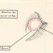
This fort consists of a single wall of earth and stone surrounding a rocky plateau, measuring 54' NE-SW x 45'.
On the SW side where the natural defence is weakest, the wall consists of stones only, and these are of large size, forming a formidable barrier 5' high in places. The entrance appears to have been on the SE where there are traces of a very steep access path.
A J Beaton 1883; A A Woodham 1956.
A sub-circular dun, occupying the summit of a knoll, naturally defended by a crag in the NE and rocky slopes in the NW and-SE. It measures overall c. 21.0m NW-SE by c. 18.0m. The base course of the outer wall face, composed mainly of conglomerate blocks, is visible around most of the perimeter, and in the W the face survives to a maximum height of 1.4m and four courses. The inner face is visible only on the W side for a distance of c. 4.0m. The wall appears to increase from c. 1.8m in the NE to c. 2.8m in the SW. The position of the entrance is not clear. At the obvious place in the SW where the wall thickens at the easiest approach, the base course of the outer face is unbroken, but there is a dip in the wall, and the stones may represent a threshold. In the SE, there is a square outer facing stone which could be the corner-stone of the NE side of the entrance, but the lack of other evidence and the steep approach up sloping outcrop makes this uncertain. The "access path" is a natural declivity.
Revised at 1/2500.
Visited by OS (N K B) 21 March 1966 and 27 November 1970.
Field Visit (July 1979)
Lundie NH 669 506 NH65SE 7
This dun measures 15.2m by 13.4m within a wall about 2.5m thick; the entrance probably lay on the SE.
RCAHMS 1979, visited July 1979
Woodham 1956, 83, no. 48

