
Pricing Change
New pricing for orders of material from this site will come into place shortly. Charges for supply of digital images, digitisation on demand, prints and licensing will be altered.
Corrymuckloch


Clearance Cairn(S) (Period Unassigned), Cup Marked Stone (Prehistoric), Field Boundary(S) (Period Unassigned), Hut Circle(S) (Prehistoric)
Site Name Corrymuckloch
Classification Clearance Cairn(S) (Period Unassigned), Cup Marked Stone (Prehistoric), Field Boundary(S) (Period Unassigned), Hut Circle(S) (Prehistoric)
Alternative Name(s) Currymuckloch
Canmore ID 135349
Site Number NN83NE 39
NGR NN 894 354
NGR Description centred on NN 894 354
Datum OSGB36 - NGR
Permalink http://canmore.org.uk/site/135349


- Council Perth And Kinross
- Parish Fowlis Wester
- Former Region Tayside
- Former District Perth And Kinross
- Former County Perthshire
NN83NE 39 centred on 894 353
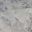
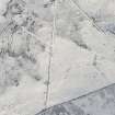
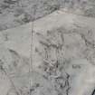
A group of three hut-circles defined by low banks and earth-fast stone, a cup-marked boulder, several small clearance cairns and minor stony banks occupy the area around NN 894 354 lying between the 310m and 320m contours.
T Cowie, M Hall, B O'Connor and R Tipping 1996

