
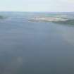
Carn Dubh, Beauly Firth


Crannog (Prehistoric)
Site Name Carn Dubh, Beauly Firth
Classification Crannog (Prehistoric)
Alternative Name(s) Coul Point; Bunchrew; Inner Moray Firth
Canmore ID 13484
Site Number NH64NW 4
NGR NH 61779 47353
Datum OSGB36 - NGR
Permalink http://canmore.org.uk/site/13484


- Council Highland
- Parish Kirkhill
- Former Region Highland
- Former District Inverness
- Former County Inverness-shire
NH64NW 4 6175 4730
A large mound of stones standing 1.25km NNW of Bunchrew may be a beacon-stance. In 1909 Blundell noted that it measured 52m by 41m and contained timber-work. In 1793 what may have been two others were visible; 'urns' are said to have been found in the largest mound.
Statistical Account (OSA) 1793; O Blundell 1910; RCAHMS 1979.
This site was further investigated by Dr Mackay and Mr Fraser of Reelig on 4 July 1936. Manuscripts and photographs held by Inverness Museum (copies in NMRS). Thought to be a crannog by Fraser.
NMRS, MS/486.
NH 617 473 Previous investigation of the site began in 1909 when the Reverend Odo Blundell discovered a number of substantial timbers on the surface and running under the boulders (supra). In 1936,members of the Inverness Field Club and Scienfific Society excavated on the SW edge of the site to corroborate Blundell's work. The excavation revealed a substantial pile showing original cut-marks surrounded by smaller timbers, organic remains, shells, brushwood and a possible whetstone (INVMG 1936).
The site is over 70m in length and 45m wide. The oval plan consists of a central circular mass, an eastern crescent and a western margin of boulders Some areas within the site consist of estuarine sands and silts in contrast to the upstanding areas of boulders, cobbles, pebbles and interstitial sediments.
Amongst the consolidated areas of the site substantial horizontal and vertical timbers are well preserved. Three timbers sampled were identified as Quercus sp. two of which had been noted and photographed by Blundell in 1909.
A random sample of the upper 30cm of sediments revealed brushwood. shells, and other organic remains. The organics are well preserved due to the waterlogged environment and the site's submergence at every high tide.
Sponsors: Historic Scotland, The Russell Trust, University of Edinburgh.
A G C Hale 1994
NH 617 473 The site was surveyed in 1994 (Hale 1994) and a number of surface timbers identified. In 1996, fieldwork sampled two of the surface timbers and they were submitted for radiocarbon assay; a large vertical pine pile was dated 280+/-50 bp (GU-4539) and the timber identified from Odo Blundell's photograph (PSAS 44, 18), was relocated and dated 2530+/-50 bp (GU-4540).
Sponsors: Historic Scotland, Society of Antiquaries of Scotland, Edinburgh University Archaeology Department, Wingate Foundation.
A G C Hale 1996
Intertidal crannog - not visited.
CFA/MORA Coastal Assessment Survey 1998.
Note (1979)
Carn Dubh, Beauly Firth NH 617 473 NH64NW 4
A large mound of stones standing 1.25km NNW of Bunchrew may be a beacon-stance. In 1909 Blundell noted that it measured 52m by 41 m and contained timber-work. In 1793 what may have been two others were visible; 'urns' are said to have been found in the largest mound.
RCAHMS 1979
Stat. Acct, ix (1793), 631-2; Blundell 1910, 16-17

