
Craigiemeg Hill


Township (Period Unassigned)
Site Name Craigiemeg Hill
Classification Township (Period Unassigned)
Canmore ID 134527
Site Number NO36NW 10
NGR NO 3040 6781
Datum OSGB36 - NGR
Permalink http://canmore.org.uk/site/134527


- Council Angus
- Parish Cortachy And Clova
- Former Region Tayside
- Former District Angus
- Former County Angus
NO36NW 10 3040 6781
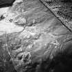
A township comprising at least fifteen buildings and enclosures, lying to the W of Craigiemeg Farm on the S-slope of Craigiemeg Hill, was recorded by Headland Archaeology during a survey of the Balnaboth Estate (NMRS MS 899/87, no.8). The buildings range in size from 5.5m by 3m to 8m by 4m externally over either stony banks or walls between 0.8m and 1m wide and standing up to 0.5m in height. The corners of one building (NMRS MS 899/87, no.8.1) are rounded whilst there are two oval buildings (NMRS MS 899/87, nos.8.9, 8.13 and 8.17) as well as a possible oval platform (NMRS MS 899/87, no.8.14). Four of the buildings (NMRS MS 899/87, nos.8.4, 8.5, 8.11 and 8.16) have a small D-shaped enclosure built against their S walls whilst two (NMRS MS899/87, nos.8.8 and 8.16) have small pens attached to their W ends. There are two enclosures set amongst the buildings (NMRS MS 899/87, nos.8.6 and 8.15).
M Dalland and S Carter (Headland Archaeology) July 1998; NMRS MS 899/87, nos.8.1 to 8.19

