
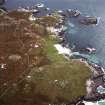
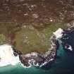
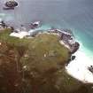
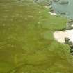
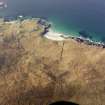
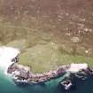
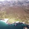
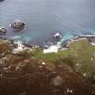
Lewis, Mealista


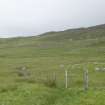
Head Dyke (Post Medieval), Lazy Beds (Post Medieval), Township (Period Unassigned)
Site Name Lewis, Mealista
Classification Head Dyke (Post Medieval), Lazy Beds (Post Medieval), Township (Period Unassigned)
Canmore ID 134087
Site Number NA92SE 13
NGR NA 9920 2420
NGR Description Centred on NA 9920 2420
Datum OSGB36 - NGR
Permalink http://canmore.org.uk/site/134087


- Council Western Isles
- Parish Uig
- Former Region Western Isles Islands Area
- Former District Western Isles
- Former County Ross And Cromarty
Note
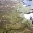
A township comprising five roofed buildings, one of which is annotated as Tigh nan Cailleachan Dubha [NA92SE 3] and another is annotated as Teampull Mhealastaidh [NA92SE 1], seventeen unroofed buildings, annotated as Ruins, several enclosures and a head-dyke is depicted on the 1st edition of the OS 6-inch map (Ross-shire, Island of Lewis 1854, sheet 29). Eighteen unroofed buildings, some sheep pens and a head-dyke are shown on the current edition of the OS 1:10000 map (1973).
Information from RCAHMS (SAH) 19 August 1997

