
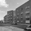
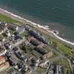
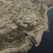
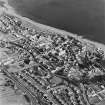
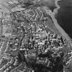
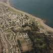
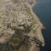
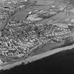
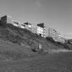
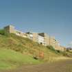
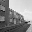
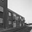
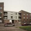
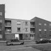
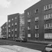
Dysart, 2 - 44 Howard Place


Term Pending (Period Unassigned)
Site Name Dysart, 2 - 44 Howard Place
Classification Term Pending (Period Unassigned)
Canmore ID 133360
Site Number NT39SW 124
NGR NT 30485 93087
NGR Description Centred NT 30485 93087
Datum OSGB36 - NGR
Permalink http://canmore.org.uk/site/133360


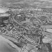
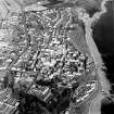

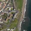
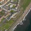
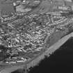
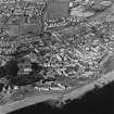
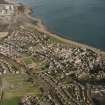

- Council Fife
- Parish Kirkcaldy And Dysart
- Former Region Fife
- Former District Kirkcaldy
- Former County Fife
NT39SW 124 centred 30485 93087
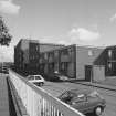
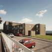
ARCHITECTS: Wheeler and Sprosan, phase I, II and III: 1958 - 77
Field Visit (28 May 1925)
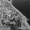
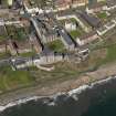
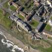
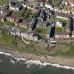
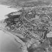
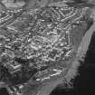
225. Houses in Dysart.
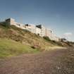
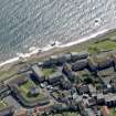
This little seaport contains a number of houses of the late 16th and the 17th century (Fig. 254). Pan tiled and harled, colour-washed or painted, they give a distinctive note to the town. Many have been altered and are now featureless, but others retain something of their original character, the following being of particular interest.
(1) [NT39SW 18] On the foreshore between St. Serf's tower and the sea, is a very picturesque harled tenement covered with a pan tiled roof (Fig. 254). It forms the front of a small court, the rear of which is a structure of the warehouse type. The entrance to the court is boldly moulded and bears on the lintel: MY HOIP IS IN THE LORD 1583. There has been an inner court, probably a stable court, behind the warehouse, and the entrance to it is an ashlar archway of 17th-century date. The front portion is an unpretentious dwelling, two storeys and a garret in height, but its crowstepped gables and heavy chimney-stalks, set at either end and corbelled out on the seaward wall, give it a character of its own. The skewputs are original and bear on north-east and south-west a male head, with moustache and beard, covered with a close bonnet and wearing a ruff; on south-east a female head with ode, wimple, and ruff. The rooms on the upper floor have been panelled and lined with pine in the 17th-century mode.
(2) [NT39SW 19] A small L-planned house, 100 yards east of St. Serf's Tower, has harled walls, slated roof, and crow-stepped gables with some good corbelling on the north gable beneath a stalk. Above a door on that face there has been inserted a panel containing a shield bearing three fleurs-de-lis and the date 1582.
(3) [NT39SW 16] "The Towers", East Port, is a tall harled house comprising a main block and wing, the latter projecting eastward to the street and containing the entrance. A panel above the entrance is initialled, apparently, C.R and RL. and dated 1589 (Fig. 257 [SC 1110374]).
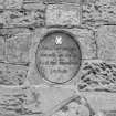
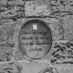
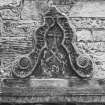
(4) [NT39SW 124] Above the entrance to a modern house in Main Street is a pediment with side scrolls inscribed, GIF . THANKIS . WNTO . THE . LORD. The scrolls converge to a fleur-de-lis finial and enclose a square-petalled flower above a hammer, with tongs below; beneath the tongs is a fleur-de-lis flanked by the initials I.W. and I.K. above the date 1585.
TOLBOOTH. [NT39SW 4] Contemporary with the above is the tower of the Tolbooth (Fig. 255 [SC 1110376]) dating, as a panel on the front testifies, from 1576. The tower is roughly square, with a stair-turret projecting from the north-east angle and has a forestair built against the south side. The forestair is an addition and on the parapet is a panel with a shield bearing a palm tree; below the shield is the date 1617. The upper part of the tower has been reconstructed in the 18th century and provided with an ashlar bell-chamber, covered with an ogival roof in stone.
RCAHMS 1933, visited 28 May 1925.

