
Pricing Change
New pricing for orders of material from this site will come into place shortly. Charges for supply of digital images, digitisation on demand, prints and licensing will be altered.
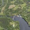
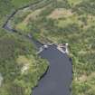
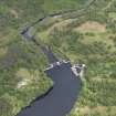
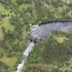
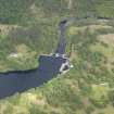
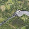
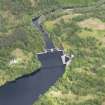
River Tummel


Building (Period Unassigned)
Site Name River Tummel
Classification Building (Period Unassigned)
Canmore ID 131863
Site Number NN86SE 53
NGR NN 8841 6030
Datum OSGB36 - NGR
Permalink http://canmore.org.uk/site/131863


- Council Perth And Kinross
- Parish Blair Atholl
- Former Region Tayside
- Former District Perth And Kinross
- Former County Perthshire
Note
An unroofed building is depicted on the 1st edition of the OS 6-inch map (Perthshire 1867, sheet xxx), but it is not shown on the current edition of the OS 1:10000 map (1993).
Information from RCAHMS (SAH) 7 October 1997

