Guardbridge, Railway Bridge
Railway Bridge (19th Century) - (20th Century)
Site Name Guardbridge, Railway Bridge
Classification Railway Bridge (19th Century) - (20th Century)
Alternative Name(s) New Guard Bridge; River Eden; Eden Viaduct
Canmore ID 131470
Site Number NO41NE 61
NGR NO 45190 18906
Datum OSGB36 - NGR
Permalink http://canmore.org.uk/site/131470
- Council Fife
- Parish Leuchars
- Former Region Fife
- Former District North East Fife
- Former County Fife
NO41NE 61 45190 18906
Location formerly entered as NO 4518 1891 and NO 4514 1891 to NO 4523 1891.
For corresponding old and new road bridges (both adjacent to S), see NO41NE 1 and NO41NE 44 respectively.
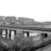
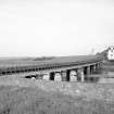
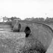
Stone circular pillars from old Railway bridge. Metal and stone crossing has been removed.
Site recorded by Maritime Fife during the Coastal Assessment Survey for Historic Scotland, Fife Ness to Newburgh 1996.
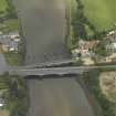
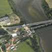
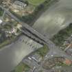
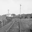
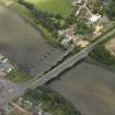
This bridge formerly carried the Leuchars-St Andrews-Crail branch line of the North British Rly across the River Eden to the E of Guardbridge village (NO41NW 71). It has been partially demolished, only the paired piers remaining (on a curved alignment which bows out towards the S).
The river here forms the boundary between the parishes of Leuchars (to the W) and St Andrews & St Leonards (to the E).
The location assigned to this record indicates the midpoint of the structure. The available map evidence indicates that it extends from NO c. 45140 18913 to NO c. 45235 18908.
This bridge is not indicated on the 1982 edition of the OS 1:10,000 map.
Information from RCAHMS (RJCM), 7 June 2006.
Project (2007)
This project was undertaken to input site information listed in 'Civil engineering heritage: Scotland - Lowlands and Borders' by R Paxton and J Shipway, 2007.
Publication Account (2007)
The circular piers adjacent to Guard Bridge old bridge (NO41NE 3) are the remains of a railway girder bridge on the St Andrews branch railway from Leuchars. It is uncertain whether these piers were those constructed for the original timber bridge designed by Thomas Bouch and built by Kenneth Mathieson of Dunfermline in 1852. The line was closed in 1969.
Paxton and Shipway 2007
Reproduced from 'Civil Engineering heritage: Scotland - Lowlands and Borders' with kind permission from Thomas Telford Publishers.


