Mains Of Gask
Ring Cairn (Neolithic) - (Bronze Age), Stone Circle (Neolithic) - (Bronze Age)
Site Name Mains Of Gask
Classification Ring Cairn (Neolithic) - (Bronze Age), Stone Circle (Neolithic) - (Bronze Age)
Canmore ID 13109
Site Number NH63NE 10
NGR NH 6794 3585
Datum OSGB36 - NGR
Permalink http://canmore.org.uk/site/13109
- Council Highland
- Parish Daviot And Dunlichity
- Former Region Highland
- Former District Inverness
- Former County Inverness-shire
NH63NE 10 6794 3585.
(NH 6794 3585) Stone Circle [NR]
OS 6"map, Inverness-shire, 2nd ed., (1905)
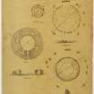
The ring-cairn is situated in undulating agricultural land above the west side of the valley, on a slight rise. The cairn is the largest of the Clava group, having a diameter of 88 feet. The kerb is almost complete though many of the stones have fallen outwards from their original positions. The largest stones are set on the south-west arc, varying between 4 feet 6 inches and 2 feet 9 inches high. Some of these have fallen but there is still an impressive length of kerbing of massive and closely set boulders towards the south side. The stones decrease in size towards the north-east and many of them only just project through the turf. Inside the kerb there remains 2 or 3 feet of cairn material mixed with earth, much disturbed and turf-covered. Through this there project two contiguous flat slabs which appear to be part of the east side of the inner circular setting. They are 27 feet from the outside of the kerb, so if the central area was concentric its diameter would be about 34 feet. Another stone which appears to be earthfast can be seen on the south but only 20 feet inside the kerb. Three upright stones belonging to a circle of monoliths survive. The dominating feature of the site is a thin flat slab standing on the west-south-west 17 feet from the kerb and opposite the largest stones. It is 11 feet in height, 9 feet 9 inches in width and only 9 inches thick. Unlike this stone the other two monoliths on the east side are irregular boulders set on end, 3 feet and 5 feet high, and set 11 feet and 13 feet from the line of the kerb. On the south east side three fallen slabs, the longest 7 feet 6 inches, are spaced evenly between the upright stones and apparently lie where they have fallen, as also a slab on the north-west side. Part of an eighth monolith lies on the north-east and another large stone 6 feet long bearing three cupmarks
(W Jolly 1882) lies against the kerb on the north-north-east. It appears to be part of a ninth monolith.
A S Henshall, visited 8 April 1957; W Jolly 1882.
There are at least three cupped stones in the Gask concentric stone circles.
(1) A large slab of red sandstone 10 1/2 feet high by 10 ft. wide and 7 to 12 ins. thick stands erect in the S.W. quadrant. It bears eleven cups between 3 1/2 and 1 1/2 in dia., and 1/4" and 5/8" deep.
(2) In the middle circle, on the S.W. side stands a block of grey granite 3 1/2 feet high by 3 feet wide. It bears sixteen cups on the front face and a single cup on the left side 6 inches from the ground. (3) A flat recumbent slab of red sandstone in the outer circle a little west of the abode, and 9 yards west of a line drawn from the centre of the circle to the middle of the large slab of red sandstone bears three cup marks. The stone is about 4 feet long and the same broad.
W Jolly 1882.
"The tallest stone at the south side of this circle of Gask, mentioned by Mr. Jolly (W Jolly 1882) as bearing cup marks seems to me to be simply a shaly sandstone flag of rough ripple-marked stratification, in some places roughly imitating cup markings."
J Fraser 1884.
The remains of this ring cairn are as described by A S Henshall (1963). No cup-marks were seen on the tall stone at the south side of the cairn (W Jolly 1882, fig. 24) but the other two described were located
Revised at 1/2500.
Visited by OS (W D J) 5 September 1963.
Nearby excavations carried out as part of a watching brief for a house development and service trench in 2003 (NH 682 358) found no archaeological features, suggesting the ring cairn is an isolated site due to its commanding view of Strathnairn.
S Farrell 2003
Field Visit (17 August 1943)
‘Stone Circle’, Mains of Gask, stands close to the Inverness-Farr road S. of the farm buildings on the crest of a low ridge overlooking the Nairn valley. It consists of an outer ring of 8 freestanding stones, the largest, to the S, being an immense slab 10'6" high x 10' wide x 1'3" thick pointed at the apex. Within this outer circle close-set blocks on end, about 2'0" to 3'0" high, form an apparently continuous ring 85' in diameter. This is the peristalith of a cairn now reduced to a virtually flat-topped mound only 3' high and covered with grass and groups of large naked stones. But 2 slabs on edge protruding through the grass 16' from the centre and set at an angle might well be the remnants of the uprights bounding a closed central chamber.
Visited by RCAHMS 17 August 1943
Field Visit (May 2011)
NH 6794 3585 A survey was carried out in May 2011 of the remains of the cairn at the request of the landowner. The site was drawn at 1:100 and photographed from all angles. Geologists gave advice on the type of stones used in the construction of the cairn and the colours they would have been in antiquity and this material was compared with the work of Bradley at Balnuaran of Clava and elsewhere. Reports of two contiguous upright stones, which may have marked the inner kerb of a ring, could not be verified and the cross sections drawn could not prove nor disprove the generally held belief that the site is a ring cairn.
Archive: ACFA Occasional Paper 115 will be deposited with RCAHMS
Anne Macdonald, ACFA
2012


