Pricing Change
New pricing for orders of material from this site will come into place shortly. Charges for supply of digital images, digitisation on demand, prints and licensing will be altered.
Edinburgh Castle, Tattoo Store And Coal Yard
Bastion (16th Century), Burial(S) (17th Century)
Site Name Edinburgh Castle, Tattoo Store And Coal Yard
Classification Bastion (16th Century), Burial(S) (17th Century)
Alternative Name(s) (New) Gift Shop; Cromwellian Steps; Guardhouse And Detention Cells
Canmore ID 129994
Site Number NT27SE 1.43
NGR NT 25207 73508
NGR Description Centred NT 25207 73508
Datum OSGB36 - NGR
Permalink http://canmore.org.uk/site/129994
First 100 images shown. See the Collections panel (below) for a link to all digital images.
- Council Edinburgh, City Of
- Parish Edinburgh (Edinburgh, City Of)
- Former Region Lothian
- Former District City Of Edinburgh
- Former County Midlothian
NT27SE 1.43 centred 2521 7351
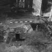
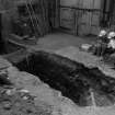
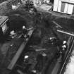
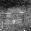
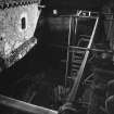
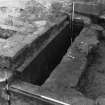
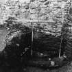
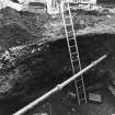
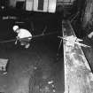
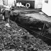
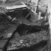
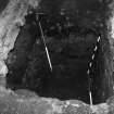
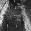
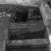
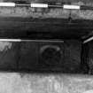
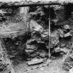
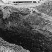
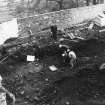
Area G. Guardhouse-Tattoo Shop, Cromwellian Steps. The Civil War period staircase was completely opened up, leading down through a very fine stone portal into the inner barrier ditch base. This structure cut through a very considerable depth of contemporary levelling material, dumped between the north and south walls. The later guardhouse walls were built up from these. The north wall was excavated to its base, a total depth of 7m. The great 17th century dump and retaining walls had been made to provide more useful space and a building plaform on the approach side of the Castle.
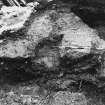
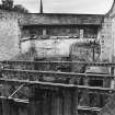
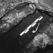
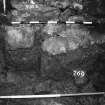
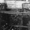
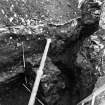
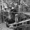
Area J and K. Detention Cells and CO's Stables Yard. The detention block was added to the west side of the guardhouse in 1866/7. As in area G, the north and south walls were built up on 17th century walls. An unexpected discovery during trial excavations here was a deeply buried broad, coursed-rubble wall, aligned NNE SSW which had been cut by the construction of the south wall, which divided this area from the approach road.
Current enlarged excavations have exposed this wall which may have formed part of an angled artillery spur, known to have been built here c1500.
Elsewhere only 17th century infilling was encountered, sealed under the modern stables yard by a well laid layer of cobbles associated with the 18th-19th century coal yard.
Sponsor : SDD (HBM)
P Yeoman, 1988a
Area G: Guardhouses-Tattoo Store, New Shop
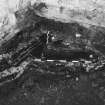
Excavations in 1988 revealed a 7m depth of deposits in this area. These deposits were completely removed to create a new gift shop of four floors. The east end of this area produced evidence of a much larger angle-pointed bastion, the north part of which projected northwards into what is now Princes Street Gardens. This can be dated to the late 15th to early 16th centuries. Evidence was found to suggest that each successive construction phase occurred in direct repsponse to damage caused during the sieges of 1544, 1573, 1640 and 1650. This bastion contained an inner gateway which allowed the main access road to pass through it, before making a dog-legged turn south to follow the presnt road-line in the east of the Portcullis Gate(NT27SE 1.4).
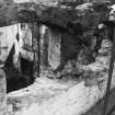
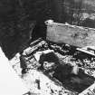
Part of the gateway survived in the outer face of the east end wall of the bastion. This can be seen today as a 4m high, infilled, flat, pointed archway. During the 17th century the road line was realigned at a higher level to the south of this area, on the route still in use. This necessitated the infilling of the bastion, which was reduced in size to form the slim-line flanker which survives in plan to this day.
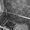
An interim phase of parapet, with slop-drain, steps and a pair of blocked gun-loops, was found on the interior face of the E end wall. These features, dating to the first half of the 17th century, were associated with the blocking of the Coal Yard Gateway, and the first major phase of infill dumping. Evidence was produced to indicate that the 'Cromwellian Steps' in the southeast corner of this flanker, were 16th century in origin. The two phases of massive spoil dumps, which raised the levels inside the flanker to that of the new road, are likely to have originated from remodelling of the outer east defences and the new dry ditch.
Areas J and K CO's Stables yard, New Shop
Further evidence was found of the stone structure reported here in 1988. It is now interpreted as a 16th century inner guardhouse, algned E-W, through which the late medieval road-line turned to the south before proceeding W to the base of the Constable's Tower. A latrine for the later guardhouse was built over this in the mid 19th century.
Area M Coal yard, Tunnel Entrance
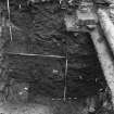
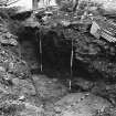
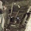
Archaeological excavations here produced the first evidence of the medieval outer defences. A pair of massive ditches, each approximately 15m wide by at least 8m deep, curved around from north to the east in front of the late medieval gateway (Area G). 14th century pottery was found in primary fills of the inner ditch. These ditches may have enlarged upon earlier defences. Banks are presumed to have been formed from the upcast. The ditches were partially infilled by the construction of the Spur in the mid-16th century. The northern portions finally being infilled when access was realigned in the first half of the 17th century.
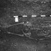
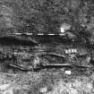
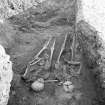
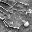
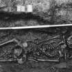
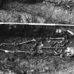
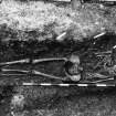
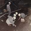
The top backfill was cut into by at least 16 graves laid out in rows with no intercutting. These burials were of young male adults, some of whom were of above average stature. A number of these exhibited signs of healed traumatic injuries. The cemetery is dated to c1650 by which time Cromwell's troops were garrisoned in the Castle.
Sponsor : SDD (HBM)
P Yeoman 1989
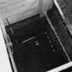
NT 252 735 A watching brief was undertaken in September 2005 during the excavation of six substantial test pits in the area known as the coal yard (NT27SE 1.43), which presently forms the open space at the E end of the castle tunnel. There were no finds or features of archaeological significance.
Archive to be deposited in NMRS.
Sponsor: HS
A Radley, D Stewart 2005
NT 252 735 Six boreholes were drilled in the area known as the Coal Yard in October 2006 in advance of the installation of six pilings to support a new ticket office at the castle (DES 2005, 64). The boreholes confirmed the presence of two ditches, but demonstrated that these were deeper than previously thought, with the inner ditch being approximately 9.6m deep and the outer ditch being over 10.7m deep. The infilling of the lower fills of both ditches appears to have been through alluviation, with the upper fills being the result of the dumping of clay and rubble
Archive to be deposited in NMRS, report to be lodged with Historic Scotland and NMRS.
Sponsor: Historic Scotland
Dr Stephen Lancaster, 2006.
Watching Brief (15 September 2005 - 3 October 2005)
NT 252 735 A watching brief was undertaken in September 2005 during the excavation of six substantial test pits in the area known as the coal yard (NT27SE 1.43), which presently forms the open space at the E end of the castle tunnel. There were no finds or features of archaeological significance.
A Radley and D Stewart 2005
Sponsor: Historic Scotland
Kirkdale Archaeology
Excavation (27 September 2006 - 21 December 2006)
NT 252 735 Watching briefs were maintained at Edinburgh Castle in late 2006 during a programme of works included in the Visitor Reception Project. The Coalyard lies at the mouth of the service tunnel and was the site of a series of six piles intended to support the new building overhead. Two trenches were dug under archaeological supervision. The first, towards the SE corner of the Coalyard, uncovered modern backfill associated with the construction of the present service tunnel to a depth of c800mm. At this depth, there was a deposit of mixed soils and post-medieval debris (18th to 19th century). The other trench lay towards the N of the yard. It was dug to a depth of 1.7m, but exposed nothing apart from post-tunnel construction debris
and services. It was used for the re-interring of human remains excavated in 1989.
Six geo-archaeological cores were retrieved by Headland Archaeology Ltd from each of the proposed pile sites and cores to the E and middle of the yard confirmed the presence of two massive defensive ditches. These ditches underlie the Coalyard and part of the Esplanade. They were first identified during work in advance of the service tunnel and the recent cores suggested that the inner ditch was c9.7m deep and the outer c10.7m.
In advance of the establishment of access to the new ticket office over the Castle Coalyard, a small trench (3 x 2m) was excavated immediately W of the Guardhouse (in the N half of the Gatehouse). This revealed the spine of a N/S-aligned vault below and prompted the examination of a series of chambers in a service passageway below the present Gatehouse. These chambers were partially infilled with rubble and were associated
with the construction of the present Gatehouse in 1887. The short survey also revealed evidence of a massive angled outer defensive wall running across the service passage floor. This rampart is the truncated remains of the angled forework of 1660-90 which was levelled some time in advance of the establishment of massive N/S-aligned 18th-century vaults to the W. A further series of vaults was constructed, aligned E/W, as foundations rather than interconnected chambers beneath the present Gatehouse.
Gordon Ewart and Alan Radley 2007
Sponsor: Historic Scotland.
Kirkdale Archaeology


