
Scrapehard


Farmstead (Period Unassigned)
Site Name Scrapehard
Classification Farmstead (Period Unassigned)
Alternative Name(s) Lauchintilly; Nether Lauchentilly; Kintore Estates
Canmore ID 129813
Site Number NJ71SW 46
NGR NJ 7445 1222
Datum OSGB36 - NGR
Permalink http://canmore.org.uk/site/129813
Ordnance Survey licence number AC0000807262. All rights reserved.
Canmore Disclaimer.
© Bluesky International Limited 2025. Public Sector Viewing Terms
- Correction
- Favourite

SC 2157624
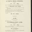
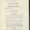
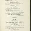
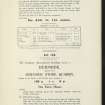
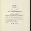
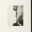
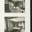
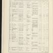
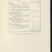
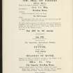
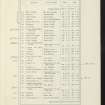
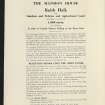
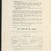
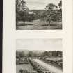
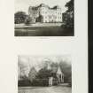
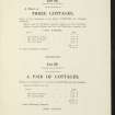
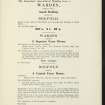
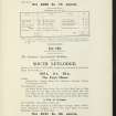
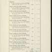
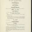
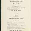
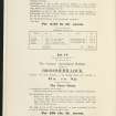
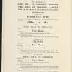
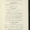
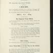
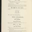
Estate Exchange. Keithhall, Ardtannes, Crichie, Balbithan, Wester Fintray, Kintore. No 1472. Sale Brochure
Collection of sale catalogues relating to Scottish estates
6/8/1914
© Courtesy of HES (Estates Exchange Collection)

SC 2157629
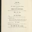
Estate Exchange. Keithhall, Ardtannes, Crichie, Balbithan, Wester Fintray, Kintore. No 1472. Sale Brochure
Collection of sale catalogues relating to Scottish estates
6/8/1914
© Courtesy of HES (Estates Exchange Collection)

SC 2157633
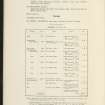
Estate Exchange. Keithhall, Ardtannes, Crichie, Balbithan, Wester Fintray, Kintore. No 1472. Sale Brochure
Collection of sale catalogues relating to Scottish estates
6/8/1914
© Courtesy of HES (Estates Exchange Collection)

SC 2157665
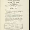
Estate Exchange. Keithhall, Ardtannes, Crichie, Balbithan, Wester Fintray, Kintore. No 1472. Sale Brochure
Collection of sale catalogues relating to Scottish estates
6/8/1914
© Courtesy of HES (Estates Exchange Collection)

SC 2157675
Estate Exchange. Keithhall, Ardtannes, Crichie, Balbithan, Wester Fintray, Kintore. No 1472. Sale Brochure
Collection of sale catalogues relating to Scottish estates
6/8/1914
© Courtesy of HES (Estates Exchange Collection)

SC 2157677
Estate Exchange. Keithhall, Ardtannes, Crichie, Balbithan, Wester Fintray, Kintore. No 1472. Sale Brochure
Collection of sale catalogues relating to Scottish estates
6/8/1914
© Courtesy of HES (Estates Exchange Collection)

SC 2157686
Estate Exchange. Keithhall, Ardtannes, Crichie, Balbithan, Wester Fintray, Kintore. No 1472. Sale Brochure
Collection of sale catalogues relating to Scottish estates
6/8/1914
© Courtesy of HES (Estates Exchange Collection)

SC 2157689
Estate Exchange. Keithhall, Ardtannes, Crichie, Balbithan, Wester Fintray, Kintore. No 1472. Sale Brochure
Collection of sale catalogues relating to Scottish estates
6/8/1914
© Courtesy of HES (Estates Exchange Collection)

SC 2157707
Estate Exchange. Keithhall, Ardtannes, Crichie, Balbithan, Wester Fintray, Kintore. No 1472. Sale Brochure
Collection of sale catalogues relating to Scottish estates
6/8/1914
© Courtesy of HES (Estates Exchange Collection)

SC 2157715
Estate Exchange. Keithhall, Ardtannes, Crichie, Balbithan, Wester Fintray, Kintore. No 1472. Sale Brochure
Collection of sale catalogues relating to Scottish estates
6/8/1914
© Courtesy of HES (Estates Exchange Collection)

SC 2157717
Estate Exchange. Keithhall, Ardtannes, Crichie, Balbithan, Wester Fintray, Kintore. No 1472. Sale Brochure
Collection of sale catalogues relating to Scottish estates
6/8/1914
© Courtesy of HES (Estates Exchange Collection)

SC 2157721
Estate Exchange. Keithhall, Ardtannes, Crichie, Balbithan, Wester Fintray, Kintore. No 1472. Sale Brochure
Collection of sale catalogues relating to Scottish estates
6/8/1914
© Courtesy of HES (Estates Exchange Collection)

SC 2157731
Estate Exchange. Keithhall, Ardtannes, Crichie, Balbithan, Wester Fintray, Kintore. No 1472. Sale Brochure
Collection of sale catalogues relating to Scottish estates
6/8/1914
© Courtesy of HES (Estates Exchange Collection)

SC 2157734
Estate Exchange. Keithhall, Ardtannes, Crichie, Balbithan, Wester Fintray, Kintore. No 1472. Sale Brochure
Collection of sale catalogues relating to Scottish estates
6/8/1914
© Courtesy of HES (Estates Exchange Collection)

SC 2157741
Estate Exchange. Keithhall, Ardtannes, Crichie, Balbithan, Wester Fintray, Kintore. No 1472. Sale Brochure
Collection of sale catalogues relating to Scottish estates
6/8/1914
© Courtesy of HES (Estates Exchange Collection)

SC 2157753
Estate Exchange. Keithhall, Ardtannes, Crichie, Balbithan, Wester Fintray, Kintore. No 1472. Sale Brochure
Collection of sale catalogues relating to Scottish estates
6/8/1914
© Courtesy of HES (Estates Exchange Collection)

SC 2157777
Estate Exchange. Keithhall, Ardtannes, Crichie, Balbithan, Wester Fintray, Kintore. No 1472. Sale Brochure
Collection of sale catalogues relating to Scottish estates
6/8/1914
© Courtesy of HES (Estates Exchange Collection)

SC 2157778
Estate Exchange. Keithhall, Ardtannes, Crichie, Balbithan, Wester Fintray, Kintore. No 1472. Sale Brochure
Collection of sale catalogues relating to Scottish estates
6/8/1914
© Courtesy of HES (Estates Exchange Collection)

SC 2157783
Estate Exchange. Keithhall, Ardtannes, Crichie, Balbithan, Wester Fintray, Kintore. No 1472. Sale Brochure
Collection of sale catalogues relating to Scottish estates
6/8/1914
© Courtesy of HES (Estates Exchange Collection)

SC 2157635
Estate Exchange. Keithhall, Ardtannes, Crichie, Balbithan, Wester Fintray, Kintore. No 1472. Sale Brochure
Collection of sale catalogues relating to Scottish estates
6/8/1914
© Courtesy of HES (Estates Exchange Collection)

SC 2157642
Estate Exchange. Keithhall, Ardtannes, Crichie, Balbithan, Wester Fintray, Kintore. No 1472. Sale Brochure
Collection of sale catalogues relating to Scottish estates
6/8/1914
© Courtesy of HES (Estates Exchange Collection)

SC 2157645
Estate Exchange. Keithhall, Ardtannes, Crichie, Balbithan, Wester Fintray, Kintore. No 1472. Sale Brochure
Collection of sale catalogues relating to Scottish estates
6/8/1914
© Courtesy of HES (Estates Exchange Collection)

SC 2157651
Estate Exchange. Keithhall, Ardtannes, Crichie, Balbithan, Wester Fintray, Kintore. No 1472. Sale Brochure
Collection of sale catalogues relating to Scottish estates
6/8/1914
© Courtesy of HES (Estates Exchange Collection)

SC 2157656
Estate Exchange. Keithhall, Ardtannes, Crichie, Balbithan, Wester Fintray, Kintore. No 1472. Sale Brochure
Collection of sale catalogues relating to Scottish estates
6/8/1914
© Courtesy of HES (Estates Exchange Collection)

SC 2157666
Estate Exchange. Keithhall, Ardtannes, Crichie, Balbithan, Wester Fintray, Kintore. No 1472. Sale Brochure
Collection of sale catalogues relating to Scottish estates
6/8/1914
© Courtesy of HES (Estates Exchange Collection)

SC 2157676
Estate Exchange. Keithhall, Ardtannes, Crichie, Balbithan, Wester Fintray, Kintore. No 1472. Sale Brochure
Collection of sale catalogues relating to Scottish estates
6/8/1914
© Courtesy of HES (Estates Exchange Collection)

SC 2157681
Estate Exchange. Keithhall, Ardtannes, Crichie, Balbithan, Wester Fintray, Kintore. No 1472. Sale Brochure
Collection of sale catalogues relating to Scottish estates
6/8/1914
© Courtesy of HES (Estates Exchange Collection)

SC 2157693
Estate Exchange. Keithhall, Ardtannes, Crichie, Balbithan, Wester Fintray, Kintore. No 1472. Sale Brochure
Collection of sale catalogues relating to Scottish estates
6/8/1914
© Courtesy of HES (Estates Exchange Collection)

SC 2157696
Estate Exchange. Keithhall, Ardtannes, Crichie, Balbithan, Wester Fintray, Kintore. No 1472. Sale Brochure
Collection of sale catalogues relating to Scottish estates
6/8/1914
© Courtesy of HES (Estates Exchange Collection)

SC 2157697
Estate Exchange. Keithhall, Ardtannes, Crichie, Balbithan, Wester Fintray, Kintore. No 1472. Sale Brochure
Collection of sale catalogues relating to Scottish estates
6/8/1914
© Courtesy of HES (Estates Exchange Collection)

SC 2157705
Estate Exchange. Keithhall, Ardtannes, Crichie, Balbithan, Wester Fintray, Kintore. No 1472. Sale Brochure
Collection of sale catalogues relating to Scottish estates
6/8/1914
© Courtesy of HES (Estates Exchange Collection)

SC 2157714
Estate Exchange. Keithhall, Ardtannes, Crichie, Balbithan, Wester Fintray, Kintore. No 1472. Sale Brochure
Collection of sale catalogues relating to Scottish estates
6/8/1914
© Courtesy of HES (Estates Exchange Collection)

SC 2157719
Estate Exchange. Keithhall, Ardtannes, Crichie, Balbithan, Wester Fintray, Kintore. No 1472. Sale Brochure
Collection of sale catalogues relating to Scottish estates
6/8/1914
© Courtesy of HES (Estates Exchange Collection)

SC 2157726
Estate Exchange. Keithhall, Ardtannes, Crichie, Balbithan, Wester Fintray, Kintore. No 1472. Sale Brochure
Collection of sale catalogues relating to Scottish estates
6/8/1914
© Courtesy of HES (Estates Exchange Collection)

SC 2157767
Estate Exchange. Keithhall, Ardtannes, Crichie, Balbithan, Wester Fintray, Kintore. No 1472. Sale Brochure
Collection of sale catalogues relating to Scottish estates
6/8/1914
© Courtesy of HES (Estates Exchange Collection)

SC 2157769
Estate Exchange. Keithhall, Ardtannes, Crichie, Balbithan, Wester Fintray, Kintore. No 1472. Sale Brochure
Collection of sale catalogues relating to Scottish estates
6/8/1914
© Courtesy of HES (Estates Exchange Collection)

SC 2157772
Estate Exchange. Keithhall, Ardtannes, Crichie, Balbithan, Wester Fintray, Kintore. No 1472. Sale Brochure
Collection of sale catalogues relating to Scottish estates
6/8/1914
© Courtesy of HES (Estates Exchange Collection)

SC 2157774
Estate Exchange. Keithhall, Ardtannes, Crichie, Balbithan, Wester Fintray, Kintore. No 1472. Sale Brochure
Collection of sale catalogues relating to Scottish estates
6/8/1914
© Courtesy of HES (Estates Exchange Collection)

SC 2157780
Estate Exchange. Keithhall, Ardtannes, Crichie, Balbithan, Wester Fintray, Kintore. No 1472. Sale Brochure
Collection of sale catalogues relating to Scottish estates
6/8/1914
© Courtesy of HES (Estates Exchange Collection)

SC 2157625
Estate Exchange. Keithhall, Ardtannes, Crichie, Balbithan, Wester Fintray, Kintore. No 1472. Sale Brochure
Collection of sale catalogues relating to Scottish estates
6/8/1914
© Courtesy of HES (Estates Exchange Collection)

SC 2157643
Estate Exchange. Keithhall, Ardtannes, Crichie, Balbithan, Wester Fintray, Kintore. No 1472. Sale Brochure
Collection of sale catalogues relating to Scottish estates
6/8/1914
© Courtesy of HES (Estates Exchange Collection)

SC 2157646
Estate Exchange. Keithhall, Ardtannes, Crichie, Balbithan, Wester Fintray, Kintore. No 1472. Sale Brochure
Collection of sale catalogues relating to Scottish estates
6/8/1914
© Courtesy of HES (Estates Exchange Collection)

SC 2157670
Estate Exchange. Keithhall, Ardtannes, Crichie, Balbithan, Wester Fintray, Kintore. No 1472. Sale Brochure
Collection of sale catalogues relating to Scottish estates
6/8/1914
© Courtesy of HES (Estates Exchange Collection)

SC 2157706
Estate Exchange. Keithhall, Ardtannes, Crichie, Balbithan, Wester Fintray, Kintore. No 1472. Sale Brochure
Collection of sale catalogues relating to Scottish estates
6/8/1914
© Courtesy of HES (Estates Exchange Collection)

SC 2157711
Estate Exchange. Keithhall, Ardtannes, Crichie, Balbithan, Wester Fintray, Kintore. No 1472. Sale Brochure
Collection of sale catalogues relating to Scottish estates
6/8/1914
© Courtesy of HES (Estates Exchange Collection)

SC 2157718
Estate Exchange. Keithhall, Ardtannes, Crichie, Balbithan, Wester Fintray, Kintore. No 1472. Sale Brochure
Collection of sale catalogues relating to Scottish estates
6/8/1914
© Courtesy of HES (Estates Exchange Collection)

SC 2157725
Estate Exchange. Keithhall, Ardtannes, Crichie, Balbithan, Wester Fintray, Kintore. No 1472. Sale Brochure
Collection of sale catalogues relating to Scottish estates
6/8/1914
© Courtesy of HES (Estates Exchange Collection)

SC 2157740
Estate Exchange. Keithhall, Ardtannes, Crichie, Balbithan, Wester Fintray, Kintore. No 1472. Sale Brochure
Collection of sale catalogues relating to Scottish estates
6/8/1914
© Courtesy of HES (Estates Exchange Collection)

SC 2157761
Estate Exchange. Keithhall, Ardtannes, Crichie, Balbithan, Wester Fintray, Kintore. No 1472. Sale Brochure
Collection of sale catalogues relating to Scottish estates
6/8/1914
© Courtesy of HES (Estates Exchange Collection)

SC 2157762
Estate Exchange. Keithhall, Ardtannes, Crichie, Balbithan, Wester Fintray, Kintore. No 1472. Sale Brochure
Collection of sale catalogues relating to Scottish estates
6/8/1914
© Courtesy of HES (Estates Exchange Collection)

SC 2157763
Estate Exchange. Keithhall, Ardtannes, Crichie, Balbithan, Wester Fintray, Kintore. No 1472. Sale Brochure
Collection of sale catalogues relating to Scottish estates
6/8/1914
© Courtesy of HES (Estates Exchange Collection)

SC 2157764
Estate Exchange. Keithhall, Ardtannes, Crichie, Balbithan, Wester Fintray, Kintore. No 1472. Sale Brochure
Collection of sale catalogues relating to Scottish estates
6/8/1914
© Courtesy of HES (Estates Exchange Collection)

SC 2157765
Estate Exchange. Keithhall, Ardtannes, Crichie, Balbithan, Wester Fintray, Kintore. No 1472. Sale Brochure
Collection of sale catalogues relating to Scottish estates
6/8/1914
© Courtesy of HES (Estates Exchange Collection)

SC 2157770
Estate Exchange. Keithhall, Ardtannes, Crichie, Balbithan, Wester Fintray, Kintore. No 1472. Sale Brochure
Collection of sale catalogues relating to Scottish estates
6/8/1914
© Courtesy of HES (Estates Exchange Collection)

SC 2157773
Estate Exchange. Keithhall, Ardtannes, Crichie, Balbithan, Wester Fintray, Kintore. No 1472. Sale Brochure
Collection of sale catalogues relating to Scottish estates
6/8/1914
© Courtesy of HES (Estates Exchange Collection)

SC 2157782
Estate Exchange. Keithhall, Ardtannes, Crichie, Balbithan, Wester Fintray, Kintore. No 1472. Sale Brochure
Collection of sale catalogues relating to Scottish estates
6/8/1914
© Courtesy of HES (Estates Exchange Collection)

SC 2157786
Estate Exchange. Keithhall, Ardtannes, Crichie, Balbithan, Wester Fintray, Kintore. No 1472. Sale Brochure
Collection of sale catalogues relating to Scottish estates
6/8/1914
© Courtesy of HES (Estates Exchange Collection)

SC 2157787
Estate Exchange. Keithhall, Ardtannes, Crichie, Balbithan, Wester Fintray, Kintore. No 1472. Sale Brochure
Collection of sale catalogues relating to Scottish estates
6/8/1914
© Courtesy of HES (Estates Exchange Collection)

SC 2157792
Estate Exchange. Keithhall, Ardtannes, Crichie, Balbithan, Wester Fintray, Kintore. No 1472. Sale Brochure
Collection of sale catalogues relating to Scottish estates
6/8/1914
© Courtesy of HES (Estates Exchange Collection)

SC 2157793
Estate Exchange. Keithhall, Ardtannes, Crichie, Balbithan, Wester Fintray, Kintore. No 1472. Sale Brochure
Collection of sale catalogues relating to Scottish estates
6/8/1914
© Courtesy of HES (Estates Exchange Collection)

SC 2157630
Estate Exchange. Keithhall, Ardtannes, Crichie, Balbithan, Wester Fintray, Kintore. No 1472. Sale Brochure
Collection of sale catalogues relating to Scottish estates
6/8/1914
© Courtesy of HES (Estates Exchange Collection)

SC 2157636
Estate Exchange. Keithhall, Ardtannes, Crichie, Balbithan, Wester Fintray, Kintore. No 1472. Sale Brochure
Collection of sale catalogues relating to Scottish estates
6/8/1914
© Courtesy of HES (Estates Exchange Collection)

SC 2157638
Estate Exchange. Keithhall, Ardtannes, Crichie, Balbithan, Wester Fintray, Kintore. No 1472. Sale Brochure
Collection of sale catalogues relating to Scottish estates
6/8/1914
© Courtesy of HES (Estates Exchange Collection)

SC 2157652
Estate Exchange. Keithhall, Ardtannes, Crichie, Balbithan, Wester Fintray, Kintore. No 1472. Sale Brochure
Collection of sale catalogues relating to Scottish estates
6/8/1914
© Courtesy of HES (Estates Exchange Collection)

SC 2157653
Estate Exchange. Keithhall, Ardtannes, Crichie, Balbithan, Wester Fintray, Kintore. No 1472. Sale Brochure
Collection of sale catalogues relating to Scottish estates
6/8/1914
© Courtesy of HES (Estates Exchange Collection)

SC 2157655
Estate Exchange. Keithhall, Ardtannes, Crichie, Balbithan, Wester Fintray, Kintore. No 1472. Sale Brochure
Collection of sale catalogues relating to Scottish estates
6/8/1914
© Courtesy of HES (Estates Exchange Collection)

SC 2157673
Estate Exchange. Keithhall, Ardtannes, Crichie, Balbithan, Wester Fintray, Kintore. No 1472. Sale Brochure
Collection of sale catalogues relating to Scottish estates
6/8/1914
© Courtesy of HES (Estates Exchange Collection)

SC 2157674
Estate Exchange. Keithhall, Ardtannes, Crichie, Balbithan, Wester Fintray, Kintore. No 1472. Sale Brochure
Collection of sale catalogues relating to Scottish estates
6/8/1914
© Courtesy of HES (Estates Exchange Collection)

SC 2157679
Estate Exchange. Keithhall, Ardtannes, Crichie, Balbithan, Wester Fintray, Kintore. No 1472. Sale Brochure
Collection of sale catalogues relating to Scottish estates
6/8/1914
© Courtesy of HES (Estates Exchange Collection)

SC 2157690
Estate Exchange. Keithhall, Ardtannes, Crichie, Balbithan, Wester Fintray, Kintore. No 1472. Sale Brochure
Collection of sale catalogues relating to Scottish estates
6/8/1914
© Courtesy of HES (Estates Exchange Collection)

SC 2157694
Estate Exchange. Keithhall, Ardtannes, Crichie, Balbithan, Wester Fintray, Kintore. No 1472. Sale Brochure
Collection of sale catalogues relating to Scottish estates
6/8/1914
© Courtesy of HES (Estates Exchange Collection)

SC 2157709
Estate Exchange. Keithhall, Ardtannes, Crichie, Balbithan, Wester Fintray, Kintore. No 1472. Sale Brochure
Collection of sale catalogues relating to Scottish estates
6/8/1914
© Courtesy of HES (Estates Exchange Collection)

SC 2157716
Estate Exchange. Keithhall, Ardtannes, Crichie, Balbithan, Wester Fintray, Kintore. No 1472. Sale Brochure
Collection of sale catalogues relating to Scottish estates
6/8/1914
© Courtesy of HES (Estates Exchange Collection)

SC 2157723
Estate Exchange. Keithhall, Ardtannes, Crichie, Balbithan, Wester Fintray, Kintore. No 1472. Sale Brochure
Collection of sale catalogues relating to Scottish estates
6/8/1914
© Courtesy of HES (Estates Exchange Collection)

SC 2157730
Estate Exchange. Keithhall, Ardtannes, Crichie, Balbithan, Wester Fintray, Kintore. No 1472. Sale Brochure
Collection of sale catalogues relating to Scottish estates
6/8/1914
© Courtesy of HES (Estates Exchange Collection)

SC 2157737
Estate Exchange. Keithhall, Ardtannes, Crichie, Balbithan, Wester Fintray, Kintore. No 1472. Sale Brochure
Collection of sale catalogues relating to Scottish estates
6/8/1914
© Courtesy of HES (Estates Exchange Collection)

SC 2157739
Estate Exchange. Keithhall, Ardtannes, Crichie, Balbithan, Wester Fintray, Kintore. No 1472. Sale Brochure
Collection of sale catalogues relating to Scottish estates
6/8/1914
© Courtesy of HES (Estates Exchange Collection)

SC 2157747
Estate Exchange. Keithhall, Ardtannes, Crichie, Balbithan, Wester Fintray, Kintore. No 1472. Sale Brochure
Collection of sale catalogues relating to Scottish estates
6/8/1914
© Courtesy of HES (Estates Exchange Collection)

SC 2157749
Estate Exchange. Keithhall, Ardtannes, Crichie, Balbithan, Wester Fintray, Kintore. No 1472. Sale Brochure
Collection of sale catalogues relating to Scottish estates
6/8/1914
© Courtesy of HES (Estates Exchange Collection)

SC 2157750
Estate Exchange. Keithhall, Ardtannes, Crichie, Balbithan, Wester Fintray, Kintore. No 1472. Sale Brochure
Collection of sale catalogues relating to Scottish estates
6/8/1914
© Courtesy of HES (Estates Exchange Collection)

SC 2157758
Estate Exchange. Keithhall, Ardtannes, Crichie, Balbithan, Wester Fintray, Kintore. No 1472. Sale Brochure
Collection of sale catalogues relating to Scottish estates
6/8/1914
© Courtesy of HES (Estates Exchange Collection)

SC 2157759
Estate Exchange. Keithhall, Ardtannes, Crichie, Balbithan, Wester Fintray, Kintore. No 1472. Sale Brochure
Collection of sale catalogues relating to Scottish estates
6/8/1914
© Courtesy of HES (Estates Exchange Collection)

SC 2157768
Estate Exchange. Keithhall, Ardtannes, Crichie, Balbithan, Wester Fintray, Kintore. No 1472. Sale Brochure
Collection of sale catalogues relating to Scottish estates
6/8/1914
© Courtesy of HES (Estates Exchange Collection)

SC 2157775
Estate Exchange. Keithhall, Ardtannes, Crichie, Balbithan, Wester Fintray, Kintore. No 1472. Sale Brochure
Collection of sale catalogues relating to Scottish estates
6/8/1914
© Courtesy of HES (Estates Exchange Collection)

SC 2157791
Estate Exchange. Keithhall, Ardtannes, Crichie, Balbithan, Wester Fintray, Kintore. No 1472. Sale Brochure
Collection of sale catalogues relating to Scottish estates
6/8/1914
© Courtesy of HES (Estates Exchange Collection)

SC 2157637
Estate Exchange. Keithhall, Ardtannes, Crichie, Balbithan, Wester Fintray, Kintore. No 1472. Sale Brochure
Collection of sale catalogues relating to Scottish estates
6/8/1914
© Courtesy of HES (Estates Exchange Collection)

SC 2157639
Estate Exchange. Keithhall, Ardtannes, Crichie, Balbithan, Wester Fintray, Kintore. No 1472. Sale Brochure
Collection of sale catalogues relating to Scottish estates
6/8/1914
© Courtesy of HES (Estates Exchange Collection)

SC 2157640
Estate Exchange. Keithhall, Ardtannes, Crichie, Balbithan, Wester Fintray, Kintore. No 1472. Sale Brochure
Collection of sale catalogues relating to Scottish estates
6/8/1914
© Courtesy of HES (Estates Exchange Collection)

SC 2157641
Estate Exchange. Keithhall, Ardtannes, Crichie, Balbithan, Wester Fintray, Kintore. No 1472. Sale Brochure
Collection of sale catalogues relating to Scottish estates
6/8/1914
© Courtesy of HES (Estates Exchange Collection)

SC 2157644
Estate Exchange. Keithhall, Ardtannes, Crichie, Balbithan, Wester Fintray, Kintore. No 1472. Sale Brochure
Collection of sale catalogues relating to Scottish estates
6/8/1914
© Courtesy of HES (Estates Exchange Collection)

SC 2157658
Estate Exchange. Keithhall, Ardtannes, Crichie, Balbithan, Wester Fintray, Kintore. No 1472. Sale Brochure
Collection of sale catalogues relating to Scottish estates
6/8/1914
© Courtesy of HES (Estates Exchange Collection)

SC 2157664
Estate Exchange. Keithhall, Ardtannes, Crichie, Balbithan, Wester Fintray, Kintore. No 1472. Sale Brochure
Collection of sale catalogues relating to Scottish estates
6/8/1914
© Courtesy of HES (Estates Exchange Collection)

SC 2157678
Estate Exchange. Keithhall, Ardtannes, Crichie, Balbithan, Wester Fintray, Kintore. No 1472. Sale Brochure
Collection of sale catalogues relating to Scottish estates
6/8/1914
© Courtesy of HES (Estates Exchange Collection)

SC 2157682
Estate Exchange. Keithhall, Ardtannes, Crichie, Balbithan, Wester Fintray, Kintore. No 1472. Sale Brochure
Collection of sale catalogues relating to Scottish estates
6/8/1914
© Courtesy of HES (Estates Exchange Collection)

SC 2157691
Estate Exchange. Keithhall, Ardtannes, Crichie, Balbithan, Wester Fintray, Kintore. No 1472. Sale Brochure
Collection of sale catalogues relating to Scottish estates
6/8/1914
© Courtesy of HES (Estates Exchange Collection)

SC 2157692
Estate Exchange. Keithhall, Ardtannes, Crichie, Balbithan, Wester Fintray, Kintore. No 1472. Sale Brochure
Collection of sale catalogues relating to Scottish estates
6/8/1914
© Courtesy of HES (Estates Exchange Collection)

SC 2157699
Estate Exchange. Keithhall, Ardtannes, Crichie, Balbithan, Wester Fintray, Kintore. No 1472. Sale Brochure
Collection of sale catalogues relating to Scottish estates
6/8/1914
© Courtesy of HES (Estates Exchange Collection)

SC 2157713
Estate Exchange. Keithhall, Ardtannes, Crichie, Balbithan, Wester Fintray, Kintore. No 1472. Sale Brochure
Collection of sale catalogues relating to Scottish estates
6/8/1914
© Courtesy of HES (Estates Exchange Collection)

SC 2157722
Estate Exchange. Keithhall, Ardtannes, Crichie, Balbithan, Wester Fintray, Kintore. No 1472. Sale Brochure
Collection of sale catalogues relating to Scottish estates
6/8/1914
© Courtesy of HES (Estates Exchange Collection)

SC 2157735
Estate Exchange. Keithhall, Ardtannes, Crichie, Balbithan, Wester Fintray, Kintore. No 1472. Sale Brochure
Collection of sale catalogues relating to Scottish estates
6/8/1914
© Courtesy of HES (Estates Exchange Collection)


First 100 images shown. See the Collections panel (below) for a link to all digital images.
- Council Aberdeenshire
- Parish Kemnay
- Former Region Grampian
- Former District Gordon
- Former County Aberdeenshire
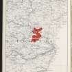
NJ71SW 46 7445 1222
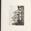
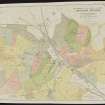
The remains of this farmstead comprise an inhabited cottage (NJ 7439 1220) and six buildings, all of which are depicted on the 1st edition of the OS 6-inch map (Aberdeenshire 1869, sheet lxiv). A U-shaped range lies, with its open side facing SE, at the NE end of the steading, six other buildings standing to the S and W. With the exception of the cottage, all of these buildings were abandoned before the end of the 19th century (1901, sheet lxiv.SE). The steading was probably abandoned in favour of a new steading, also called Scrapehard, which was built about 260m to the S. This steading, later renamed Nether Lauchintilly (NJ71SW 102) is depicted on the 2nd edition map.
Visited by RCAHMS (JRS, ATW), 29 September 1998

