
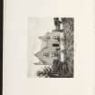
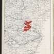
Burnside


Farmhouse (Period Unassigned), Farmstead (Period Unassigned)
Site Name Burnside
Classification Farmhouse (Period Unassigned), Farmstead (Period Unassigned)
Canmore ID 129672
Site Number NJ71SE 61
NGR NJ 7736 1202
Datum OSGB36 - NGR
Permalink http://canmore.org.uk/site/129672
Ordnance Survey licence number AC0000807262. All rights reserved.
Canmore Disclaimer.
© Bluesky International Limited 2025. Public Sector Viewing Terms
- Correction
- Favourite

SC 2157624
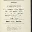
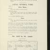
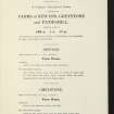
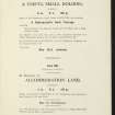
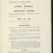
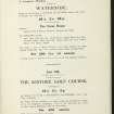
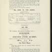
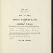
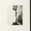
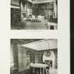
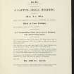
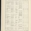
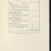
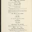
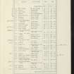
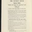
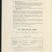
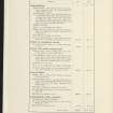
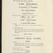
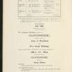
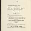
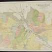
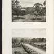
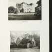
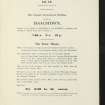
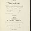
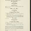
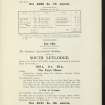
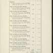
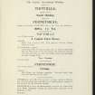
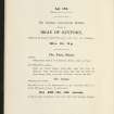
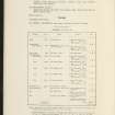
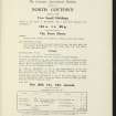
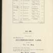
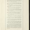
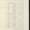
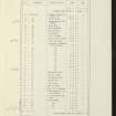
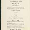
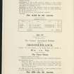
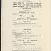
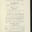
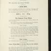
Estate Exchange. Keithhall, Ardtannes, Crichie, Balbithan, Wester Fintray, Kintore. No 1472. Sale Brochure
Collection of sale catalogues relating to Scottish estates
6/8/1914
© Courtesy of HES (Estates Exchange Collection)

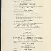
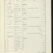
SC 2157629
Estate Exchange. Keithhall, Ardtannes, Crichie, Balbithan, Wester Fintray, Kintore. No 1472. Sale Brochure
Collection of sale catalogues relating to Scottish estates
6/8/1914
© Courtesy of HES (Estates Exchange Collection)

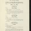
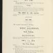
SC 2157633
Estate Exchange. Keithhall, Ardtannes, Crichie, Balbithan, Wester Fintray, Kintore. No 1472. Sale Brochure
Collection of sale catalogues relating to Scottish estates
6/8/1914
© Courtesy of HES (Estates Exchange Collection)

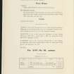
SC 2157665
Estate Exchange. Keithhall, Ardtannes, Crichie, Balbithan, Wester Fintray, Kintore. No 1472. Sale Brochure
Collection of sale catalogues relating to Scottish estates
6/8/1914
© Courtesy of HES (Estates Exchange Collection)

SC 2157675
Estate Exchange. Keithhall, Ardtannes, Crichie, Balbithan, Wester Fintray, Kintore. No 1472. Sale Brochure
Collection of sale catalogues relating to Scottish estates
6/8/1914
© Courtesy of HES (Estates Exchange Collection)

SC 2157677
Estate Exchange. Keithhall, Ardtannes, Crichie, Balbithan, Wester Fintray, Kintore. No 1472. Sale Brochure
Collection of sale catalogues relating to Scottish estates
6/8/1914
© Courtesy of HES (Estates Exchange Collection)

SC 2157686
Estate Exchange. Keithhall, Ardtannes, Crichie, Balbithan, Wester Fintray, Kintore. No 1472. Sale Brochure
Collection of sale catalogues relating to Scottish estates
6/8/1914
© Courtesy of HES (Estates Exchange Collection)

SC 2157689
Estate Exchange. Keithhall, Ardtannes, Crichie, Balbithan, Wester Fintray, Kintore. No 1472. Sale Brochure
Collection of sale catalogues relating to Scottish estates
6/8/1914
© Courtesy of HES (Estates Exchange Collection)

SC 2157707
Estate Exchange. Keithhall, Ardtannes, Crichie, Balbithan, Wester Fintray, Kintore. No 1472. Sale Brochure
Collection of sale catalogues relating to Scottish estates
6/8/1914
© Courtesy of HES (Estates Exchange Collection)

SC 2157715
Estate Exchange. Keithhall, Ardtannes, Crichie, Balbithan, Wester Fintray, Kintore. No 1472. Sale Brochure
Collection of sale catalogues relating to Scottish estates
6/8/1914
© Courtesy of HES (Estates Exchange Collection)

SC 2157717
Estate Exchange. Keithhall, Ardtannes, Crichie, Balbithan, Wester Fintray, Kintore. No 1472. Sale Brochure
Collection of sale catalogues relating to Scottish estates
6/8/1914
© Courtesy of HES (Estates Exchange Collection)

SC 2157721
Estate Exchange. Keithhall, Ardtannes, Crichie, Balbithan, Wester Fintray, Kintore. No 1472. Sale Brochure
Collection of sale catalogues relating to Scottish estates
6/8/1914
© Courtesy of HES (Estates Exchange Collection)

SC 2157731
Estate Exchange. Keithhall, Ardtannes, Crichie, Balbithan, Wester Fintray, Kintore. No 1472. Sale Brochure
Collection of sale catalogues relating to Scottish estates
6/8/1914
© Courtesy of HES (Estates Exchange Collection)

SC 2157734
Estate Exchange. Keithhall, Ardtannes, Crichie, Balbithan, Wester Fintray, Kintore. No 1472. Sale Brochure
Collection of sale catalogues relating to Scottish estates
6/8/1914
© Courtesy of HES (Estates Exchange Collection)

SC 2157741
Estate Exchange. Keithhall, Ardtannes, Crichie, Balbithan, Wester Fintray, Kintore. No 1472. Sale Brochure
Collection of sale catalogues relating to Scottish estates
6/8/1914
© Courtesy of HES (Estates Exchange Collection)

SC 2157753
Estate Exchange. Keithhall, Ardtannes, Crichie, Balbithan, Wester Fintray, Kintore. No 1472. Sale Brochure
Collection of sale catalogues relating to Scottish estates
6/8/1914
© Courtesy of HES (Estates Exchange Collection)

SC 2157777
Estate Exchange. Keithhall, Ardtannes, Crichie, Balbithan, Wester Fintray, Kintore. No 1472. Sale Brochure
Collection of sale catalogues relating to Scottish estates
6/8/1914
© Courtesy of HES (Estates Exchange Collection)

SC 2157778
Estate Exchange. Keithhall, Ardtannes, Crichie, Balbithan, Wester Fintray, Kintore. No 1472. Sale Brochure
Collection of sale catalogues relating to Scottish estates
6/8/1914
© Courtesy of HES (Estates Exchange Collection)

SC 2157783
Estate Exchange. Keithhall, Ardtannes, Crichie, Balbithan, Wester Fintray, Kintore. No 1472. Sale Brochure
Collection of sale catalogues relating to Scottish estates
6/8/1914
© Courtesy of HES (Estates Exchange Collection)

SC 2157635
Estate Exchange. Keithhall, Ardtannes, Crichie, Balbithan, Wester Fintray, Kintore. No 1472. Sale Brochure
Collection of sale catalogues relating to Scottish estates
6/8/1914
© Courtesy of HES (Estates Exchange Collection)

SC 2157642
Estate Exchange. Keithhall, Ardtannes, Crichie, Balbithan, Wester Fintray, Kintore. No 1472. Sale Brochure
Collection of sale catalogues relating to Scottish estates
6/8/1914
© Courtesy of HES (Estates Exchange Collection)

SC 2157645
Estate Exchange. Keithhall, Ardtannes, Crichie, Balbithan, Wester Fintray, Kintore. No 1472. Sale Brochure
Collection of sale catalogues relating to Scottish estates
6/8/1914
© Courtesy of HES (Estates Exchange Collection)

SC 2157651
Estate Exchange. Keithhall, Ardtannes, Crichie, Balbithan, Wester Fintray, Kintore. No 1472. Sale Brochure
Collection of sale catalogues relating to Scottish estates
6/8/1914
© Courtesy of HES (Estates Exchange Collection)

SC 2157656
Estate Exchange. Keithhall, Ardtannes, Crichie, Balbithan, Wester Fintray, Kintore. No 1472. Sale Brochure
Collection of sale catalogues relating to Scottish estates
6/8/1914
© Courtesy of HES (Estates Exchange Collection)

SC 2157666
Estate Exchange. Keithhall, Ardtannes, Crichie, Balbithan, Wester Fintray, Kintore. No 1472. Sale Brochure
Collection of sale catalogues relating to Scottish estates
6/8/1914
© Courtesy of HES (Estates Exchange Collection)

SC 2157676
Estate Exchange. Keithhall, Ardtannes, Crichie, Balbithan, Wester Fintray, Kintore. No 1472. Sale Brochure
Collection of sale catalogues relating to Scottish estates
6/8/1914
© Courtesy of HES (Estates Exchange Collection)

SC 2157681
Estate Exchange. Keithhall, Ardtannes, Crichie, Balbithan, Wester Fintray, Kintore. No 1472. Sale Brochure
Collection of sale catalogues relating to Scottish estates
6/8/1914
© Courtesy of HES (Estates Exchange Collection)

SC 2157693
Estate Exchange. Keithhall, Ardtannes, Crichie, Balbithan, Wester Fintray, Kintore. No 1472. Sale Brochure
Collection of sale catalogues relating to Scottish estates
6/8/1914
© Courtesy of HES (Estates Exchange Collection)

SC 2157696
Estate Exchange. Keithhall, Ardtannes, Crichie, Balbithan, Wester Fintray, Kintore. No 1472. Sale Brochure
Collection of sale catalogues relating to Scottish estates
6/8/1914
© Courtesy of HES (Estates Exchange Collection)

SC 2157697
Estate Exchange. Keithhall, Ardtannes, Crichie, Balbithan, Wester Fintray, Kintore. No 1472. Sale Brochure
Collection of sale catalogues relating to Scottish estates
6/8/1914
© Courtesy of HES (Estates Exchange Collection)

SC 2157705
Estate Exchange. Keithhall, Ardtannes, Crichie, Balbithan, Wester Fintray, Kintore. No 1472. Sale Brochure
Collection of sale catalogues relating to Scottish estates
6/8/1914
© Courtesy of HES (Estates Exchange Collection)

SC 2157714
Estate Exchange. Keithhall, Ardtannes, Crichie, Balbithan, Wester Fintray, Kintore. No 1472. Sale Brochure
Collection of sale catalogues relating to Scottish estates
6/8/1914
© Courtesy of HES (Estates Exchange Collection)

SC 2157719
Estate Exchange. Keithhall, Ardtannes, Crichie, Balbithan, Wester Fintray, Kintore. No 1472. Sale Brochure
Collection of sale catalogues relating to Scottish estates
6/8/1914
© Courtesy of HES (Estates Exchange Collection)

SC 2157726
Estate Exchange. Keithhall, Ardtannes, Crichie, Balbithan, Wester Fintray, Kintore. No 1472. Sale Brochure
Collection of sale catalogues relating to Scottish estates
6/8/1914
© Courtesy of HES (Estates Exchange Collection)

SC 2157767
Estate Exchange. Keithhall, Ardtannes, Crichie, Balbithan, Wester Fintray, Kintore. No 1472. Sale Brochure
Collection of sale catalogues relating to Scottish estates
6/8/1914
© Courtesy of HES (Estates Exchange Collection)

SC 2157769
Estate Exchange. Keithhall, Ardtannes, Crichie, Balbithan, Wester Fintray, Kintore. No 1472. Sale Brochure
Collection of sale catalogues relating to Scottish estates
6/8/1914
© Courtesy of HES (Estates Exchange Collection)

SC 2157772
Estate Exchange. Keithhall, Ardtannes, Crichie, Balbithan, Wester Fintray, Kintore. No 1472. Sale Brochure
Collection of sale catalogues relating to Scottish estates
6/8/1914
© Courtesy of HES (Estates Exchange Collection)

SC 2157774
Estate Exchange. Keithhall, Ardtannes, Crichie, Balbithan, Wester Fintray, Kintore. No 1472. Sale Brochure
Collection of sale catalogues relating to Scottish estates
6/8/1914
© Courtesy of HES (Estates Exchange Collection)

SC 2157780
Estate Exchange. Keithhall, Ardtannes, Crichie, Balbithan, Wester Fintray, Kintore. No 1472. Sale Brochure
Collection of sale catalogues relating to Scottish estates
6/8/1914
© Courtesy of HES (Estates Exchange Collection)

SC 2157625
Estate Exchange. Keithhall, Ardtannes, Crichie, Balbithan, Wester Fintray, Kintore. No 1472. Sale Brochure
Collection of sale catalogues relating to Scottish estates
6/8/1914
© Courtesy of HES (Estates Exchange Collection)

SC 2157643
Estate Exchange. Keithhall, Ardtannes, Crichie, Balbithan, Wester Fintray, Kintore. No 1472. Sale Brochure
Collection of sale catalogues relating to Scottish estates
6/8/1914
© Courtesy of HES (Estates Exchange Collection)

SC 2157646
Estate Exchange. Keithhall, Ardtannes, Crichie, Balbithan, Wester Fintray, Kintore. No 1472. Sale Brochure
Collection of sale catalogues relating to Scottish estates
6/8/1914
© Courtesy of HES (Estates Exchange Collection)

SC 2157670
Estate Exchange. Keithhall, Ardtannes, Crichie, Balbithan, Wester Fintray, Kintore. No 1472. Sale Brochure
Collection of sale catalogues relating to Scottish estates
6/8/1914
© Courtesy of HES (Estates Exchange Collection)

SC 2157706
Estate Exchange. Keithhall, Ardtannes, Crichie, Balbithan, Wester Fintray, Kintore. No 1472. Sale Brochure
Collection of sale catalogues relating to Scottish estates
6/8/1914
© Courtesy of HES (Estates Exchange Collection)

SC 2157711
Estate Exchange. Keithhall, Ardtannes, Crichie, Balbithan, Wester Fintray, Kintore. No 1472. Sale Brochure
Collection of sale catalogues relating to Scottish estates
6/8/1914
© Courtesy of HES (Estates Exchange Collection)

SC 2157718
Estate Exchange. Keithhall, Ardtannes, Crichie, Balbithan, Wester Fintray, Kintore. No 1472. Sale Brochure
Collection of sale catalogues relating to Scottish estates
6/8/1914
© Courtesy of HES (Estates Exchange Collection)

SC 2157725
Estate Exchange. Keithhall, Ardtannes, Crichie, Balbithan, Wester Fintray, Kintore. No 1472. Sale Brochure
Collection of sale catalogues relating to Scottish estates
6/8/1914
© Courtesy of HES (Estates Exchange Collection)

SC 2157740
Estate Exchange. Keithhall, Ardtannes, Crichie, Balbithan, Wester Fintray, Kintore. No 1472. Sale Brochure
Collection of sale catalogues relating to Scottish estates
6/8/1914
© Courtesy of HES (Estates Exchange Collection)

SC 2157761
Estate Exchange. Keithhall, Ardtannes, Crichie, Balbithan, Wester Fintray, Kintore. No 1472. Sale Brochure
Collection of sale catalogues relating to Scottish estates
6/8/1914
© Courtesy of HES (Estates Exchange Collection)

SC 2157762
Estate Exchange. Keithhall, Ardtannes, Crichie, Balbithan, Wester Fintray, Kintore. No 1472. Sale Brochure
Collection of sale catalogues relating to Scottish estates
6/8/1914
© Courtesy of HES (Estates Exchange Collection)

SC 2157763
Estate Exchange. Keithhall, Ardtannes, Crichie, Balbithan, Wester Fintray, Kintore. No 1472. Sale Brochure
Collection of sale catalogues relating to Scottish estates
6/8/1914
© Courtesy of HES (Estates Exchange Collection)

SC 2157764
Estate Exchange. Keithhall, Ardtannes, Crichie, Balbithan, Wester Fintray, Kintore. No 1472. Sale Brochure
Collection of sale catalogues relating to Scottish estates
6/8/1914
© Courtesy of HES (Estates Exchange Collection)

SC 2157765
Estate Exchange. Keithhall, Ardtannes, Crichie, Balbithan, Wester Fintray, Kintore. No 1472. Sale Brochure
Collection of sale catalogues relating to Scottish estates
6/8/1914
© Courtesy of HES (Estates Exchange Collection)

SC 2157770
Estate Exchange. Keithhall, Ardtannes, Crichie, Balbithan, Wester Fintray, Kintore. No 1472. Sale Brochure
Collection of sale catalogues relating to Scottish estates
6/8/1914
© Courtesy of HES (Estates Exchange Collection)

SC 2157773
Estate Exchange. Keithhall, Ardtannes, Crichie, Balbithan, Wester Fintray, Kintore. No 1472. Sale Brochure
Collection of sale catalogues relating to Scottish estates
6/8/1914
© Courtesy of HES (Estates Exchange Collection)

SC 2157782
Estate Exchange. Keithhall, Ardtannes, Crichie, Balbithan, Wester Fintray, Kintore. No 1472. Sale Brochure
Collection of sale catalogues relating to Scottish estates
6/8/1914
© Courtesy of HES (Estates Exchange Collection)

SC 2157786
Estate Exchange. Keithhall, Ardtannes, Crichie, Balbithan, Wester Fintray, Kintore. No 1472. Sale Brochure
Collection of sale catalogues relating to Scottish estates
6/8/1914
© Courtesy of HES (Estates Exchange Collection)

SC 2157787
Estate Exchange. Keithhall, Ardtannes, Crichie, Balbithan, Wester Fintray, Kintore. No 1472. Sale Brochure
Collection of sale catalogues relating to Scottish estates
6/8/1914
© Courtesy of HES (Estates Exchange Collection)

SC 2157792
Estate Exchange. Keithhall, Ardtannes, Crichie, Balbithan, Wester Fintray, Kintore. No 1472. Sale Brochure
Collection of sale catalogues relating to Scottish estates
6/8/1914
© Courtesy of HES (Estates Exchange Collection)

SC 2157793
Estate Exchange. Keithhall, Ardtannes, Crichie, Balbithan, Wester Fintray, Kintore. No 1472. Sale Brochure
Collection of sale catalogues relating to Scottish estates
6/8/1914
© Courtesy of HES (Estates Exchange Collection)

SC 2157630
Estate Exchange. Keithhall, Ardtannes, Crichie, Balbithan, Wester Fintray, Kintore. No 1472. Sale Brochure
Collection of sale catalogues relating to Scottish estates
6/8/1914
© Courtesy of HES (Estates Exchange Collection)

SC 2157636
Estate Exchange. Keithhall, Ardtannes, Crichie, Balbithan, Wester Fintray, Kintore. No 1472. Sale Brochure
Collection of sale catalogues relating to Scottish estates
6/8/1914
© Courtesy of HES (Estates Exchange Collection)

SC 2157638
Estate Exchange. Keithhall, Ardtannes, Crichie, Balbithan, Wester Fintray, Kintore. No 1472. Sale Brochure
Collection of sale catalogues relating to Scottish estates
6/8/1914
© Courtesy of HES (Estates Exchange Collection)

SC 2157652
Estate Exchange. Keithhall, Ardtannes, Crichie, Balbithan, Wester Fintray, Kintore. No 1472. Sale Brochure
Collection of sale catalogues relating to Scottish estates
6/8/1914
© Courtesy of HES (Estates Exchange Collection)

SC 2157653
Estate Exchange. Keithhall, Ardtannes, Crichie, Balbithan, Wester Fintray, Kintore. No 1472. Sale Brochure
Collection of sale catalogues relating to Scottish estates
6/8/1914
© Courtesy of HES (Estates Exchange Collection)

SC 2157655
Estate Exchange. Keithhall, Ardtannes, Crichie, Balbithan, Wester Fintray, Kintore. No 1472. Sale Brochure
Collection of sale catalogues relating to Scottish estates
6/8/1914
© Courtesy of HES (Estates Exchange Collection)

SC 2157673
Estate Exchange. Keithhall, Ardtannes, Crichie, Balbithan, Wester Fintray, Kintore. No 1472. Sale Brochure
Collection of sale catalogues relating to Scottish estates
6/8/1914
© Courtesy of HES (Estates Exchange Collection)

SC 2157674
Estate Exchange. Keithhall, Ardtannes, Crichie, Balbithan, Wester Fintray, Kintore. No 1472. Sale Brochure
Collection of sale catalogues relating to Scottish estates
6/8/1914
© Courtesy of HES (Estates Exchange Collection)

SC 2157679
Estate Exchange. Keithhall, Ardtannes, Crichie, Balbithan, Wester Fintray, Kintore. No 1472. Sale Brochure
Collection of sale catalogues relating to Scottish estates
6/8/1914
© Courtesy of HES (Estates Exchange Collection)

SC 2157690
Estate Exchange. Keithhall, Ardtannes, Crichie, Balbithan, Wester Fintray, Kintore. No 1472. Sale Brochure
Collection of sale catalogues relating to Scottish estates
6/8/1914
© Courtesy of HES (Estates Exchange Collection)

SC 2157694
Estate Exchange. Keithhall, Ardtannes, Crichie, Balbithan, Wester Fintray, Kintore. No 1472. Sale Brochure
Collection of sale catalogues relating to Scottish estates
6/8/1914
© Courtesy of HES (Estates Exchange Collection)

SC 2157709
Estate Exchange. Keithhall, Ardtannes, Crichie, Balbithan, Wester Fintray, Kintore. No 1472. Sale Brochure
Collection of sale catalogues relating to Scottish estates
6/8/1914
© Courtesy of HES (Estates Exchange Collection)

SC 2157716
Estate Exchange. Keithhall, Ardtannes, Crichie, Balbithan, Wester Fintray, Kintore. No 1472. Sale Brochure
Collection of sale catalogues relating to Scottish estates
6/8/1914
© Courtesy of HES (Estates Exchange Collection)

SC 2157723
Estate Exchange. Keithhall, Ardtannes, Crichie, Balbithan, Wester Fintray, Kintore. No 1472. Sale Brochure
Collection of sale catalogues relating to Scottish estates
6/8/1914
© Courtesy of HES (Estates Exchange Collection)

SC 2157730
Estate Exchange. Keithhall, Ardtannes, Crichie, Balbithan, Wester Fintray, Kintore. No 1472. Sale Brochure
Collection of sale catalogues relating to Scottish estates
6/8/1914
© Courtesy of HES (Estates Exchange Collection)

SC 2157737
Estate Exchange. Keithhall, Ardtannes, Crichie, Balbithan, Wester Fintray, Kintore. No 1472. Sale Brochure
Collection of sale catalogues relating to Scottish estates
6/8/1914
© Courtesy of HES (Estates Exchange Collection)

SC 2157739
Estate Exchange. Keithhall, Ardtannes, Crichie, Balbithan, Wester Fintray, Kintore. No 1472. Sale Brochure
Collection of sale catalogues relating to Scottish estates
6/8/1914
© Courtesy of HES (Estates Exchange Collection)

SC 2157747
Estate Exchange. Keithhall, Ardtannes, Crichie, Balbithan, Wester Fintray, Kintore. No 1472. Sale Brochure
Collection of sale catalogues relating to Scottish estates
6/8/1914
© Courtesy of HES (Estates Exchange Collection)

SC 2157749
Estate Exchange. Keithhall, Ardtannes, Crichie, Balbithan, Wester Fintray, Kintore. No 1472. Sale Brochure
Collection of sale catalogues relating to Scottish estates
6/8/1914
© Courtesy of HES (Estates Exchange Collection)

SC 2157750
Estate Exchange. Keithhall, Ardtannes, Crichie, Balbithan, Wester Fintray, Kintore. No 1472. Sale Brochure
Collection of sale catalogues relating to Scottish estates
6/8/1914
© Courtesy of HES (Estates Exchange Collection)

SC 2157758
Estate Exchange. Keithhall, Ardtannes, Crichie, Balbithan, Wester Fintray, Kintore. No 1472. Sale Brochure
Collection of sale catalogues relating to Scottish estates
6/8/1914
© Courtesy of HES (Estates Exchange Collection)

SC 2157759
Estate Exchange. Keithhall, Ardtannes, Crichie, Balbithan, Wester Fintray, Kintore. No 1472. Sale Brochure
Collection of sale catalogues relating to Scottish estates
6/8/1914
© Courtesy of HES (Estates Exchange Collection)

SC 2157768
Estate Exchange. Keithhall, Ardtannes, Crichie, Balbithan, Wester Fintray, Kintore. No 1472. Sale Brochure
Collection of sale catalogues relating to Scottish estates
6/8/1914
© Courtesy of HES (Estates Exchange Collection)

SC 2157775
Estate Exchange. Keithhall, Ardtannes, Crichie, Balbithan, Wester Fintray, Kintore. No 1472. Sale Brochure
Collection of sale catalogues relating to Scottish estates
6/8/1914
© Courtesy of HES (Estates Exchange Collection)

SC 2157791
Estate Exchange. Keithhall, Ardtannes, Crichie, Balbithan, Wester Fintray, Kintore. No 1472. Sale Brochure
Collection of sale catalogues relating to Scottish estates
6/8/1914
© Courtesy of HES (Estates Exchange Collection)

SC 2157637
Estate Exchange. Keithhall, Ardtannes, Crichie, Balbithan, Wester Fintray, Kintore. No 1472. Sale Brochure
Collection of sale catalogues relating to Scottish estates
6/8/1914
© Courtesy of HES (Estates Exchange Collection)

SC 2157639
Estate Exchange. Keithhall, Ardtannes, Crichie, Balbithan, Wester Fintray, Kintore. No 1472. Sale Brochure
Collection of sale catalogues relating to Scottish estates
6/8/1914
© Courtesy of HES (Estates Exchange Collection)

SC 2157640
Estate Exchange. Keithhall, Ardtannes, Crichie, Balbithan, Wester Fintray, Kintore. No 1472. Sale Brochure
Collection of sale catalogues relating to Scottish estates
6/8/1914
© Courtesy of HES (Estates Exchange Collection)

SC 2157641
Estate Exchange. Keithhall, Ardtannes, Crichie, Balbithan, Wester Fintray, Kintore. No 1472. Sale Brochure
Collection of sale catalogues relating to Scottish estates
6/8/1914
© Courtesy of HES (Estates Exchange Collection)

SC 2157644
Estate Exchange. Keithhall, Ardtannes, Crichie, Balbithan, Wester Fintray, Kintore. No 1472. Sale Brochure
Collection of sale catalogues relating to Scottish estates
6/8/1914
© Courtesy of HES (Estates Exchange Collection)

SC 2157658
Estate Exchange. Keithhall, Ardtannes, Crichie, Balbithan, Wester Fintray, Kintore. No 1472. Sale Brochure
Collection of sale catalogues relating to Scottish estates
6/8/1914
© Courtesy of HES (Estates Exchange Collection)

SC 2157664
Estate Exchange. Keithhall, Ardtannes, Crichie, Balbithan, Wester Fintray, Kintore. No 1472. Sale Brochure
Collection of sale catalogues relating to Scottish estates
6/8/1914
© Courtesy of HES (Estates Exchange Collection)

SC 2157678
Estate Exchange. Keithhall, Ardtannes, Crichie, Balbithan, Wester Fintray, Kintore. No 1472. Sale Brochure
Collection of sale catalogues relating to Scottish estates
6/8/1914
© Courtesy of HES (Estates Exchange Collection)

SC 2157682
Estate Exchange. Keithhall, Ardtannes, Crichie, Balbithan, Wester Fintray, Kintore. No 1472. Sale Brochure
Collection of sale catalogues relating to Scottish estates
6/8/1914
© Courtesy of HES (Estates Exchange Collection)

SC 2157691
Estate Exchange. Keithhall, Ardtannes, Crichie, Balbithan, Wester Fintray, Kintore. No 1472. Sale Brochure
Collection of sale catalogues relating to Scottish estates
6/8/1914
© Courtesy of HES (Estates Exchange Collection)

SC 2157692
Estate Exchange. Keithhall, Ardtannes, Crichie, Balbithan, Wester Fintray, Kintore. No 1472. Sale Brochure
Collection of sale catalogues relating to Scottish estates
6/8/1914
© Courtesy of HES (Estates Exchange Collection)

SC 2157699
Estate Exchange. Keithhall, Ardtannes, Crichie, Balbithan, Wester Fintray, Kintore. No 1472. Sale Brochure
Collection of sale catalogues relating to Scottish estates
6/8/1914
© Courtesy of HES (Estates Exchange Collection)

SC 2157713
Estate Exchange. Keithhall, Ardtannes, Crichie, Balbithan, Wester Fintray, Kintore. No 1472. Sale Brochure
Collection of sale catalogues relating to Scottish estates
6/8/1914
© Courtesy of HES (Estates Exchange Collection)

SC 2157722
Estate Exchange. Keithhall, Ardtannes, Crichie, Balbithan, Wester Fintray, Kintore. No 1472. Sale Brochure
Collection of sale catalogues relating to Scottish estates
6/8/1914
© Courtesy of HES (Estates Exchange Collection)

SC 2157735
Estate Exchange. Keithhall, Ardtannes, Crichie, Balbithan, Wester Fintray, Kintore. No 1472. Sale Brochure
Collection of sale catalogues relating to Scottish estates
6/8/1914
© Courtesy of HES (Estates Exchange Collection)


First 100 images shown. See the Collections panel (below) for a link to all digital images.
- Council Aberdeenshire
- Parish Kintore
- Former Region Grampian
- Former District Gordon
- Former County Aberdeenshire
NJ71SE 61.00 7736 1202
NJ71SE 61.01 7728 1244 Burnside Cottage
NJ71SE 61.02 7722 1254 Burnside Cottages

