
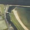
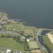
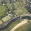
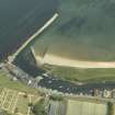
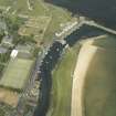
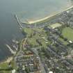
St Andrews Harbour, Upper Harbour, West Quay


Quay (Period Unassigned)
Site Name St Andrews Harbour, Upper Harbour, West Quay
Classification Quay (Period Unassigned)
Alternative Name(s) Kinness Burn
Canmore ID 129449
Site Number NO51NW 63.08
NGR NO 5160 1656
NGR Description NO 5160 1657 to 5161 1639
Datum OSGB36 - NGR
Permalink http://canmore.org.uk/site/129449


- Council Fife
- Parish St Andrews And St Leonards
- Former Region Fife
- Former District North East Fife
- Former County Fife
NO51NW 63.08 5160 1656 to 5161 1639
For description, see NO51NW 63.00.

